

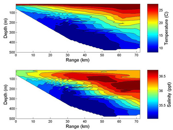
This figure denotes the temperature and salinity distributions from the edge of the continental shelf out to about the center of the Gulf Stream. The intersection of the colored and white region denotes the bottom. The outer continental shelf is on the left, where the water depth is about 70 m. The maximum water depth occurs at about 55 km offshore.
Related Links
Investigating the Charleston Bump Exploration