

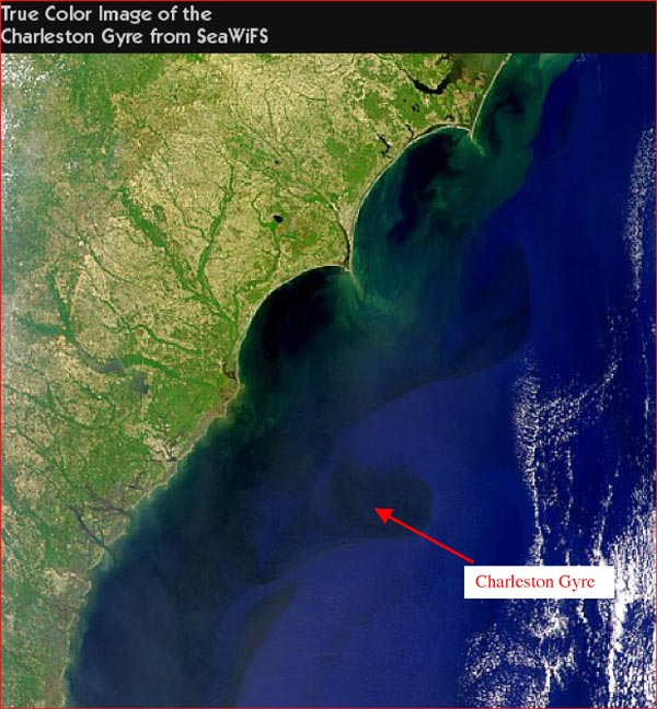
Figure 4. Sea-viewing Wide Field-of-view Sensor (SeaWiFS) image of the Charleston Gyre and regional coastline. The gyre is generated by the interaction of the Gulf Stream with the Charleston Bump, which is located just southwest of the gyre. The background SeaWifs image was produced by Norman Kuring of the SeaWiFS Project, NASA GSFC, and is available on the Internet at:NASA GSFC ![]()
Related Links
Investigating the Charleston Bump Exploration
Investigating the Charleston Bump: Convergence of Geology and Physics