

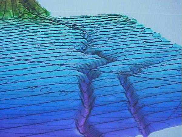
A three-dimensional image of our mapping efforts of the Hudson Canyon. Horizontal black lines indicate our mapping tracklines. Contour lines, also showing, connect points of equal magnitude above and below the seafloor surface. (Note: image shown with vertical exaggeration to highlight features) Image courtesy of Hudson Canyon Cruise 2002, NOAA/OER.