

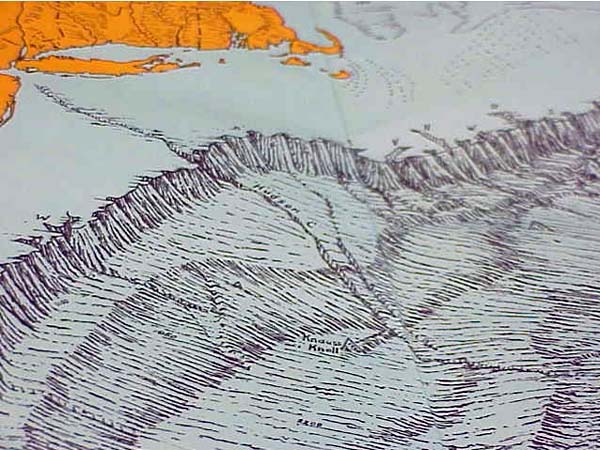
Another type of sea floor map made in 1968 by Heezan and Tharp. This map shows a rendition of the Hudson Canyon based on echo sounding. With this type of map, sea floor features appear more like 3-dimensional pictures, and are much easier to visualize than the contour line maps. Image courtesy of Hudson Canyon Cruise 2002, NOAA/OER.