

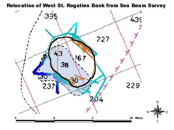
SeaBeam survey of West St. Rogatien Bank overlaid on a nautical chart with depth chart soundings (large numbers) in fathoms. The thick black line is an interpretation of the location of the 100 fathom contour based on the color coding of the SeaBeam data (100 fathoms lies between the brown and blue color change). Note that the shape and location of the actual bank is different than shown on the nautical chart. The true location is approximately two nautical miles northeast from that shown on the chart (light blue area surrounded by dashed black line).