

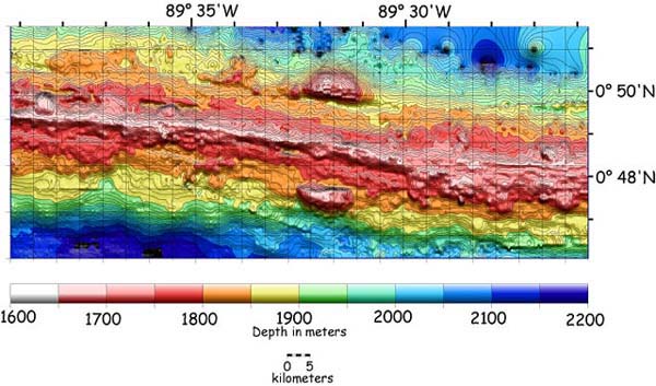
This is a multibeam bathymetric map of the area we have been investigating these past few days. Colors show the depth to the seafloor in meters. Blue colors are deeper depths and pink to white colors show the shallow area along the ridge axis. Note the ~300 m tall split volcano between 89° 31'W and 89° 32'W on either side of the ridge axis. It is likely that this volcano was formed at the ridge axis and has since been split apart by seafloor spreading. The northern half-volcano lies on the Cocos Plate and the opposing one is on the Nazca Plate. We will be studying the area to the west of the split-volcano with Alvin, the CTD, ABE and the towed camera system for the rest of this expedition. Map produced by: Dan Scheirer