The West Mata Volcano, encircled by a white ellipse on this bathymetric map, is not the largest volcano in the northeast Lau Basin, but appears to be the most active.  This map represents the area visited and mapped on two recent expeditions to the area. The summit of West Mata Volcano is nearly one mile deep the base is nearly two miles deep. The Tonga Trench to the north and east of the expedition area is nearly seven miles deep.  Map courtesy of NOAA.

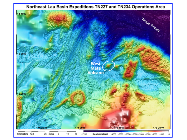
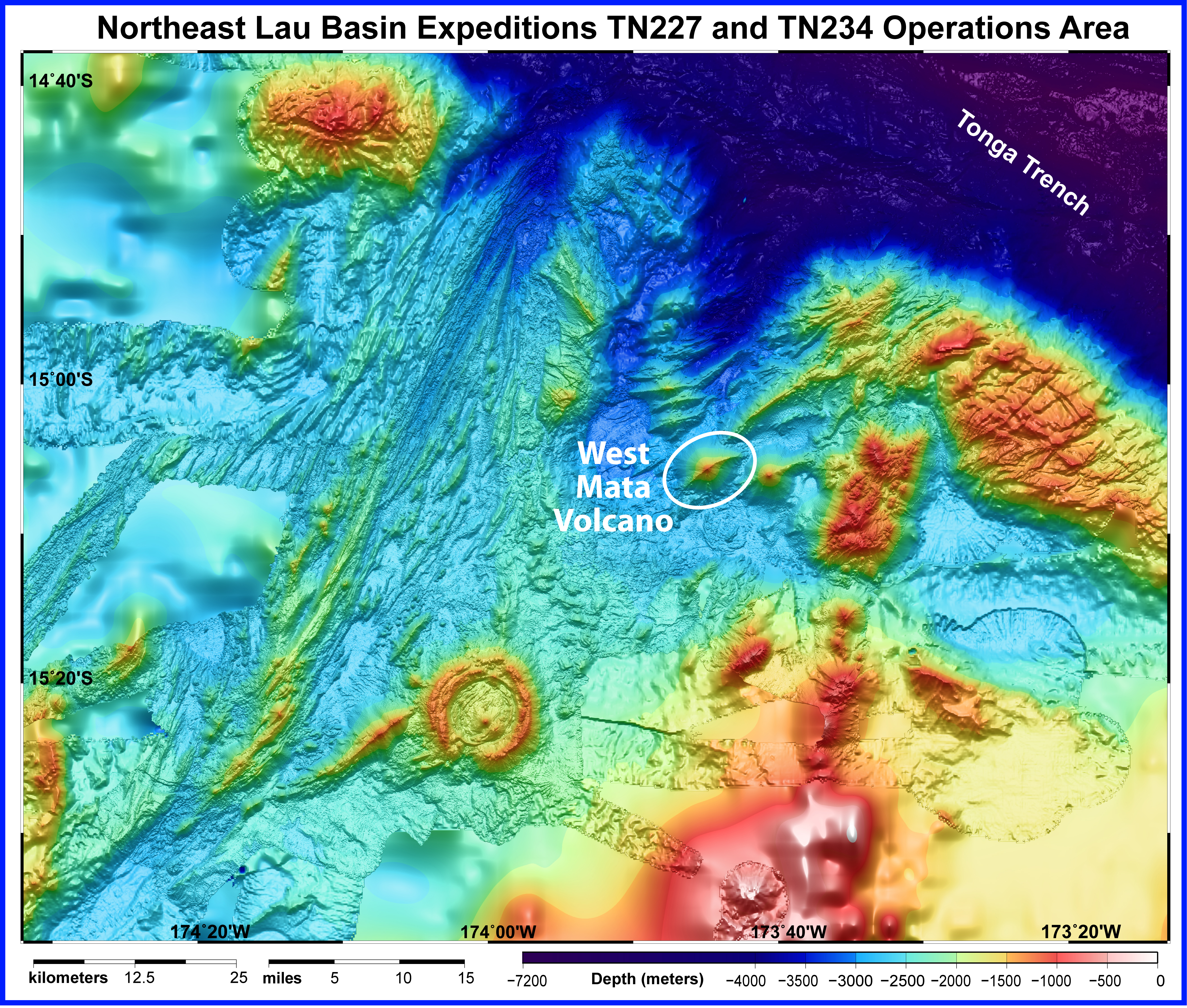
The West Mata volcano is not the largest volcano in the northeast Lau Basin, but it appears to be the most active. This bathymetric (water depth) map represents the area visited and mapped on two recent expeditions to the area. The summit of West Mata volcano is nearly 1 mile (1.6 kilometers) deep; the base is nearly 2 miles (3.2 km) deep. The Tonga Trench to the north and east of the expedition area is nearly 7 miles (11.2 km) deep. Map courtesy of NOAA.

Related Links

Northeast Lau Response Cruise 2009: Mission Summary

NOAA Ocean Explorer Gallery

Download high-resolution image (jpg, 13.7 Mb)