

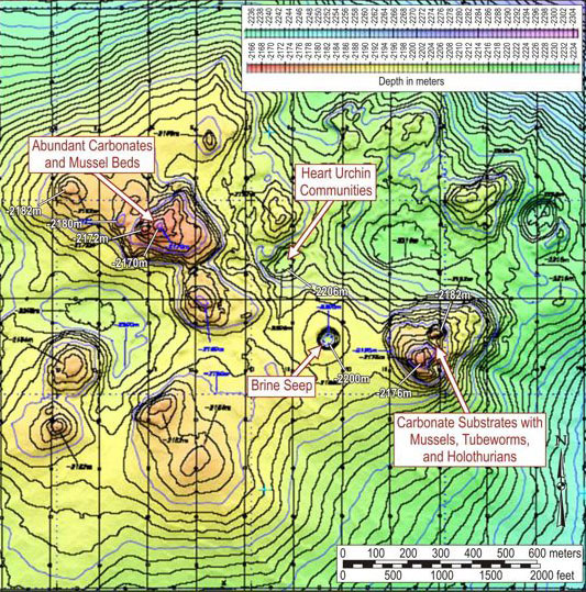
The AUV data was used to complete this high resolution bathymetric map of the Atwater Valley 340 site. Several of the habitats visited with the Alvin submersible during last summer’s cruise are located on the map. We are conducting detailed sampling at many of these habitats during this cruise. Image courtesy of Harry Roberts, Louisiana State University.
Related Links
Expedition to the Deep Slope 2007