

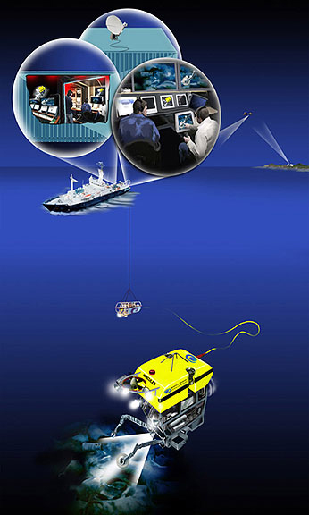
Telepresence technology uses satellite technology and Internet2 to transmit data and video in real-time from remotely operated vehicles (ROVs) working at depth, to a shore-based hub at the University of Rhode Island, which then sends this data to a variety of receiving stations on shore.Image courtesy of Paul Oberlander, Woods Hole Oceanographic Institute.
Related Links
Okeanos Explorer: A New Paradigm for Exploration