

Slideshow
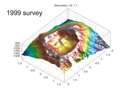
View a slide show of multi-beam maps showing the Vailulu'u crater when it was mapped in 1999, and again in 2005. Click on the left and right arrow to scroll through the pictures one by one, or select the play button for an automatic slideshow. This page is best viewed in Netscape 7.1+ or Internet Explorer 5+.
Number of Pictures: of
![]()
![]()
![]()
Related Links