

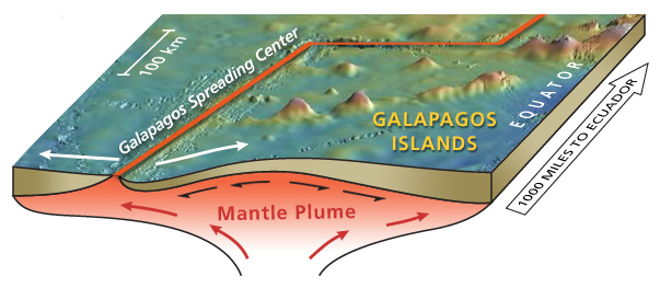
Diagram of the eastern equatorial Pacific showing the location of the Galapagos Spreading Center and Galapagos Islands. Deeper regions (>3500 m deep) are blue on this map. The Galapagos Spreading Center is an east-west ridge that rises above the surrounding seafloor, and is most shallow (depth ~1600 m) north of the Galapagos Islands. Image courtesy of Haymon et al., NOAA-OE, WHOI.
Related Links
GalAPAGoS: Where Ridge Meets Hotspot