map of location of extuaries to the abyss expedition


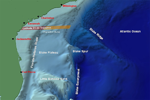
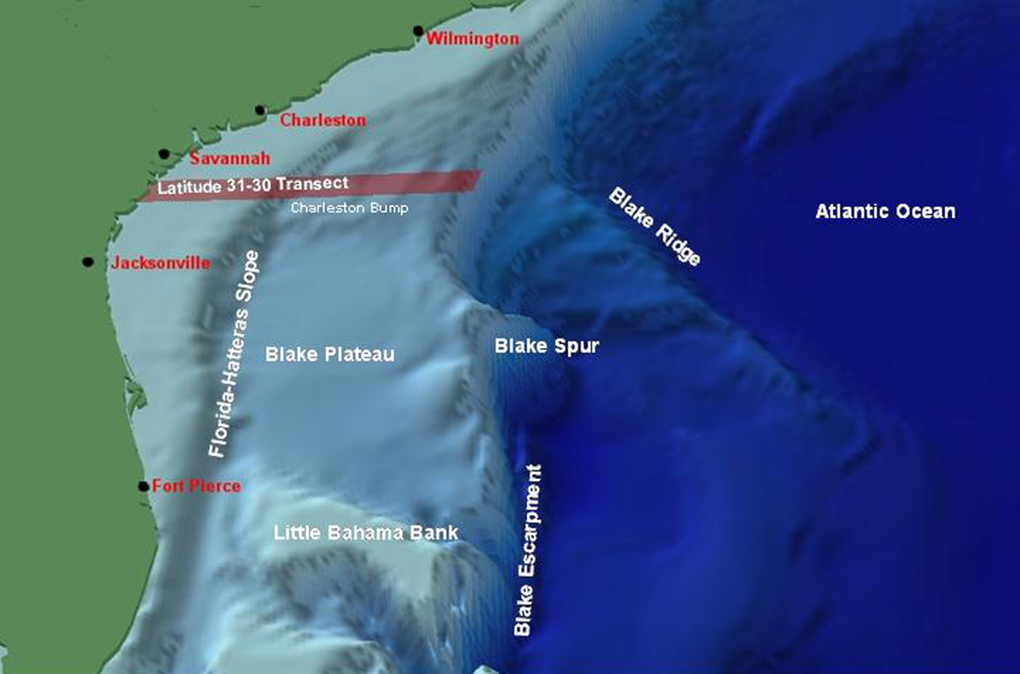
The "Latitude 31-30 Transect" line that extends from the Georgia coast to the deep sea.  The "Estuaries to the Abyss" expedition will study marine life in deeper waters of the Transect (marked in orange) to complement previous studies of shallow-water faunas. Image courtesy of P. Weinbach, SCDNR

Related Links

Estuary to the Abyss

NOAA Ocean Explorer Gallery

Download high-resolution image (jpg, 568 Kb)


social media flickr rss twitter podcast rss youtube
E-mail Updates | User Survey | Report Error On This Page | Site Index | Contact Us | Privacy Policy
Revised August 26, 2010 by the Ocean Explorer Webmaster
National Oceanic and Atmospheric Administration | U.S. Department of Commerce
NOAA Logo Commerce Logo
http://oceanexplorer.noaa.gov/explorations/04etta/background/plan/media/sig.html