

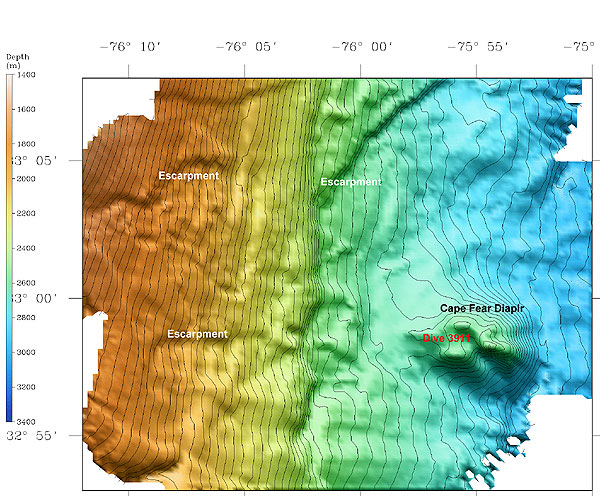
Seabeam bathymetric map in an area near the head of the Cape Fear submarine slide and the Cape Fear salt diapir. Dive 3911 explored the depression on top of the salt diapir. The escarpments mark steep bathymetric changes where overlying material slid down slopes toward the east, revealing older rock layers below. The Cape Fear slide is the largest submarine slide on the U.S. East Coast, with a slide scar measuring over 30 km north to south and a rubble field stretching more than 200 km seaward from the escarpment. Researchers believe that gas hydrate and free gas in the sediments contribute to massive slope destabilization and the formation of features like the Cape Fear slide. Photo courtesy of C. Ruppel.
Related Links
Windows to the Deep Exploration