

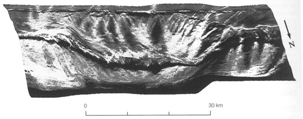
Figure 1. 3-D view of the scarp looking south toward Puerto Rico. The image was created by draping the sidescan image on sea floor bathymetry from a grid of single-beam depth sounding profiles at intervals of about 8 km. In 1990, the work to produce this single image took about one month. Dark lines crossing the image from left to right are artifacts along the nadir (the point directly beneath the boat or transducer) of the sidescan swaths.