back banner NOAA Home Page Ocean Explorer Home Page

back arrow Back

Simplified cross-section showing a slice through the geologic layers under the Gulf of Mexico


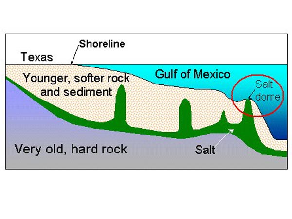
Simplified cross-section showing a slice through the geologic layers under the Gulf of Mexico. The layers shown in this view are about 600 km wide and 15 km thick, so compared to the real dimensions of these units the diagram is stretched vertically about 13-fold to show detail. The salt domes are also shown wider than they really are.


Related Links

Gulf of Mexico 2003

Gulf of Mexico 2003: Sept 23 Log

NOAA Ocean Explorer Gallery


E-mail Updates | User Survey | Report Error On This Page | Site Index | Contact Us
Revised July 11, 2005 by the Ocean Explorer Webmaster
National Oceanic and Atmospheric Administration | U.S. Department of Commerce
NOAA Logo Commerce Logo
http://oceanexplorer.noaa.gov/explorations/03mex/logs/sept23/media/braton_image1.html