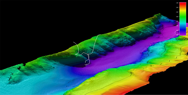
The dive track (white line) for Dive 10: Behm Canal, of the Seascape Alaska 5: Gulf of Alaska Remotely Operated Vehicle Exploration expedition. Bathymetry shown at one-time exaggeration; 100 meter contours. Scale is water depth in meters.