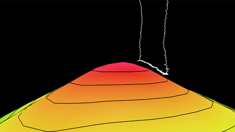
Dive 01 Track
The dive track (white line) taken by remotely operated vehicles Deep Discoverer and Seirios during Dive 01 of the Papahānaumokuākea ROV and Mapping expedition with two times vertical exaggeration and with 100-meter (328-foot) contour intervals.