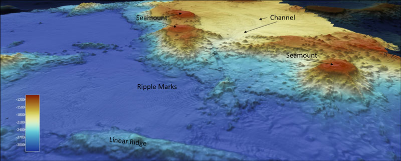
Bathymetric Map
A bathymetric map of several volcanic and fluvial features, including seamounts, a linear ridge, ripple marks, and channel ways, mapped during the second Johnston Atoll Mapping expedition. The cooler colors indicate a deeper depth, and the warmer colors a shallower depth, at a 2:1 ratio.