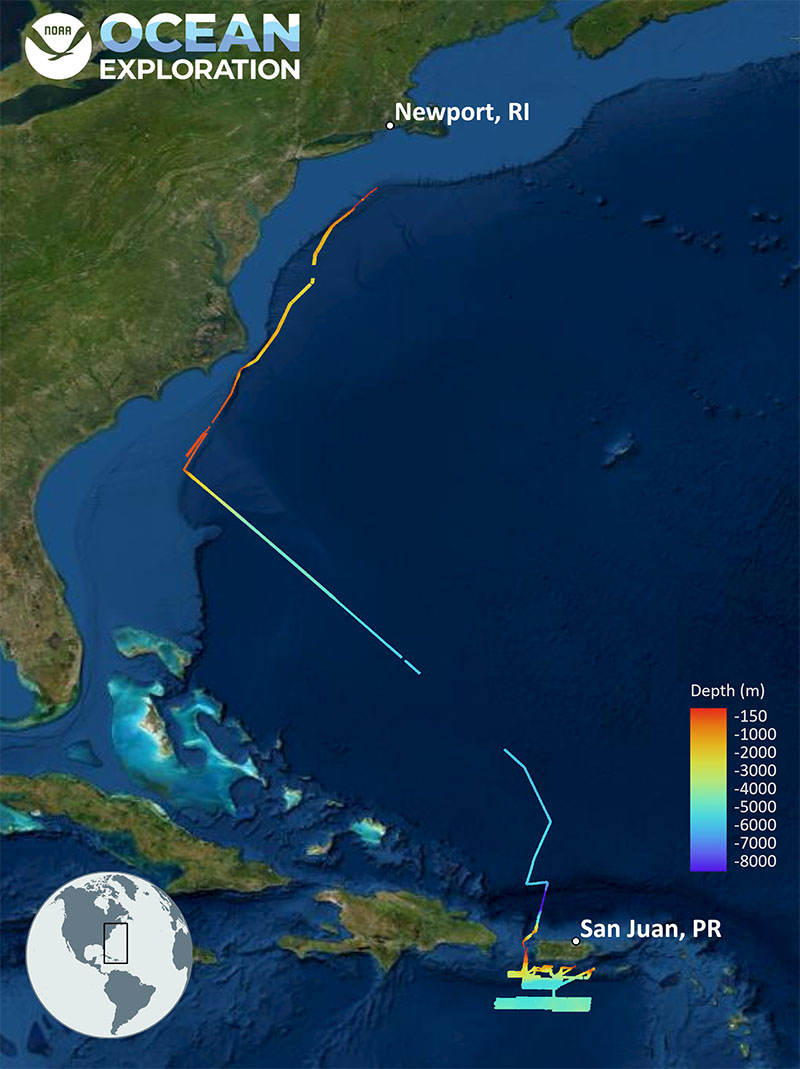
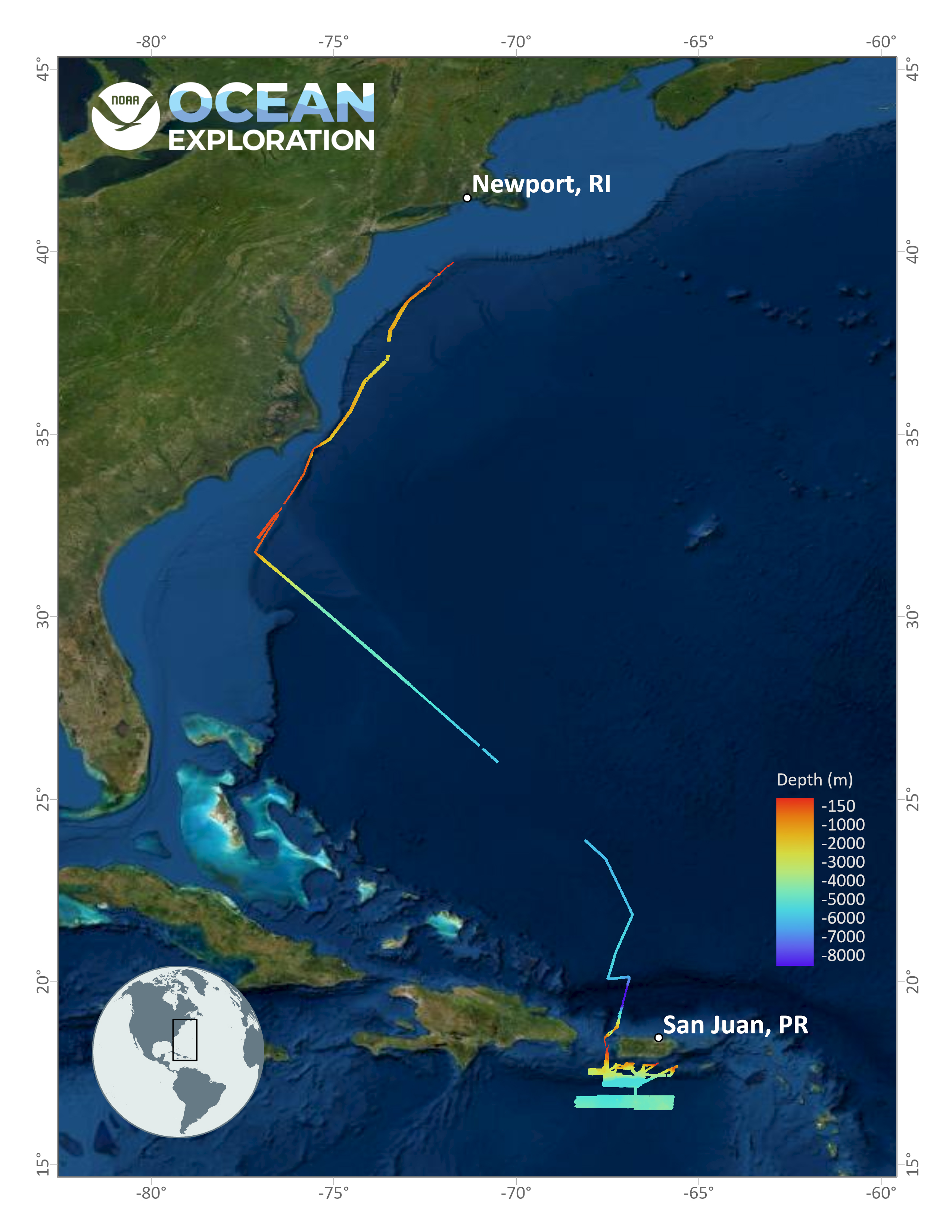
The mapping data collected (lines colored by depth in meters) and the general operating area for the 2022 Puerto Rico Mapping and Deep-Sea Camera Demonstration expedition.