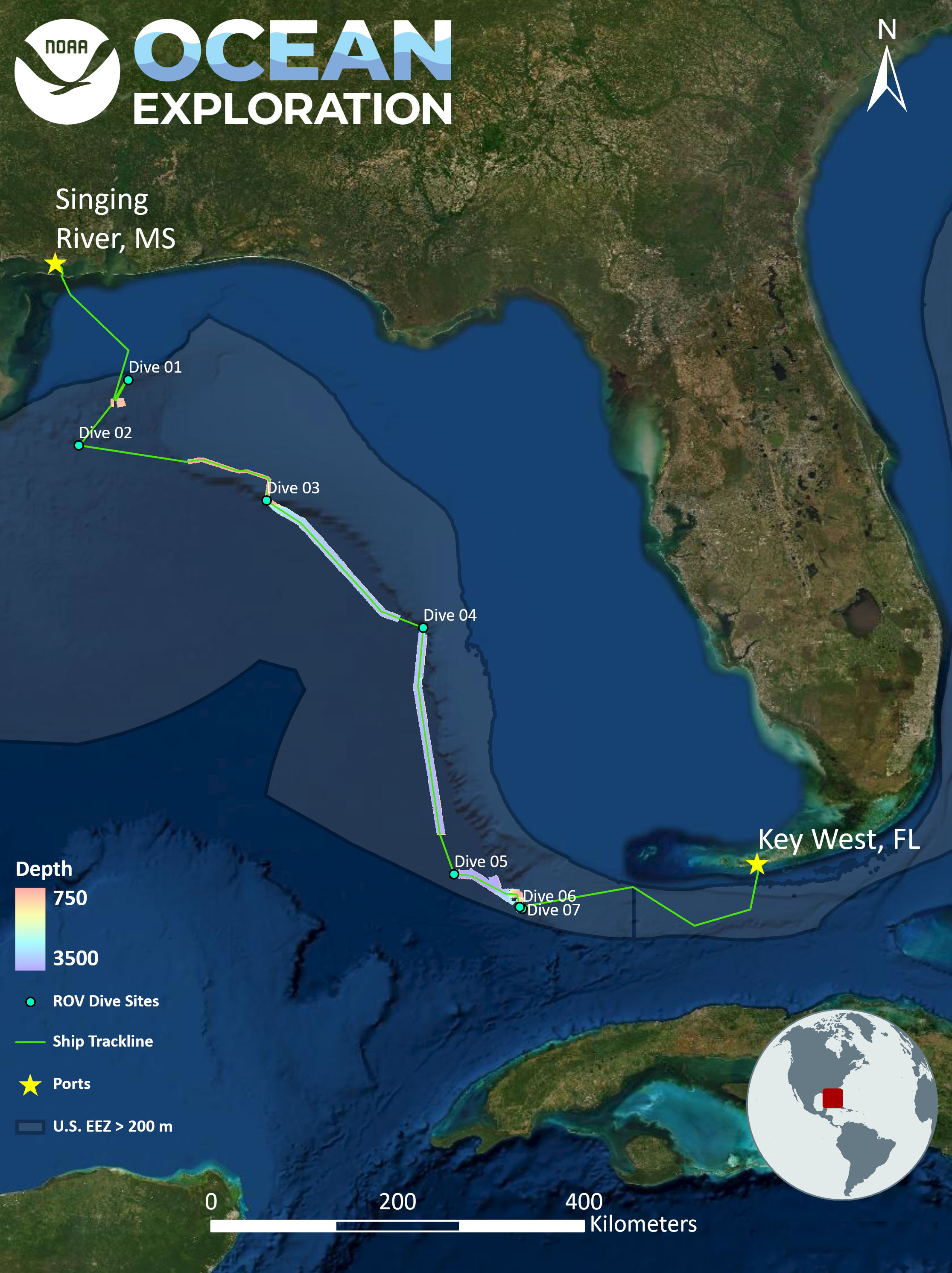
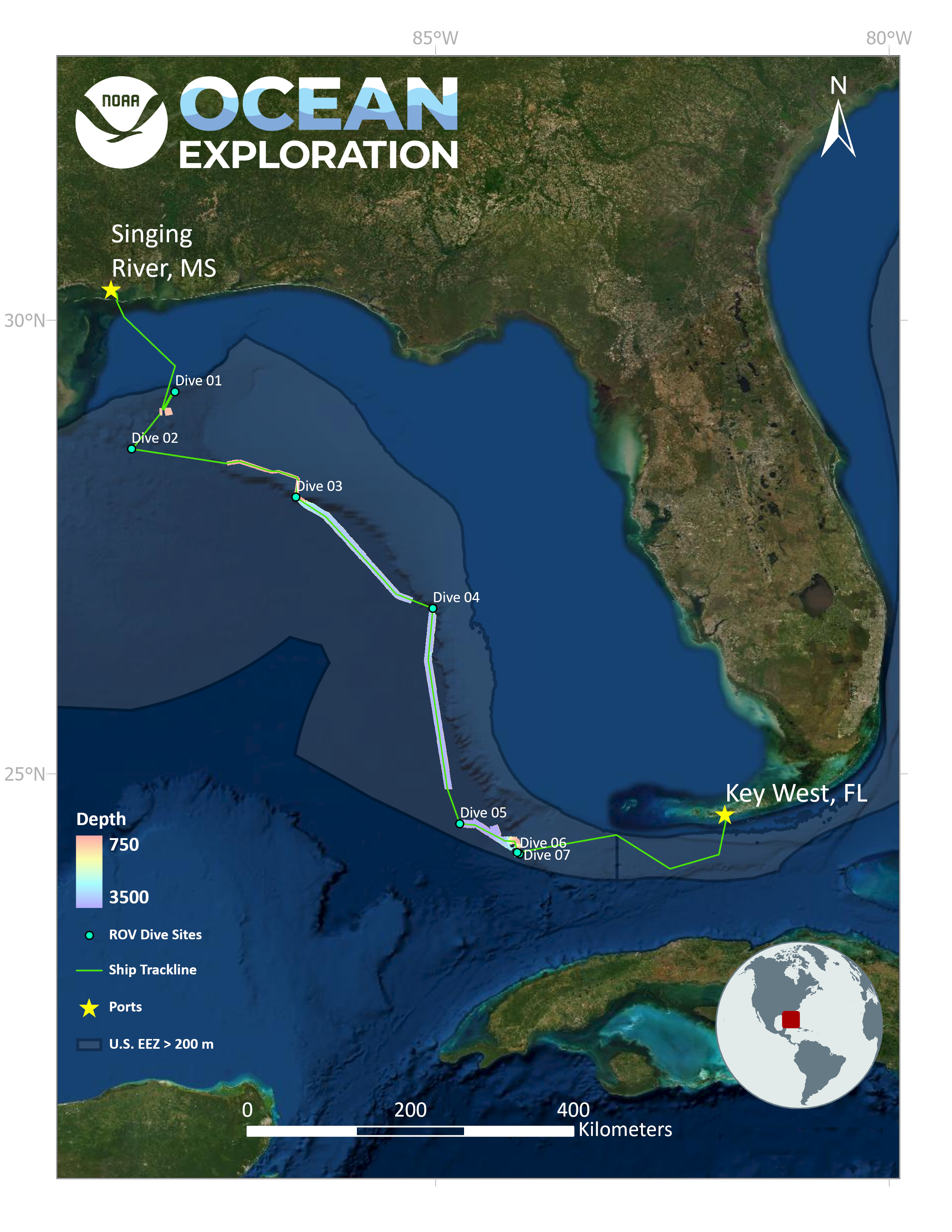
This map shows the mapping data collected (lines colored by depth) and remotely operated vehicle dive sites (green dots) for the 2022 ROV and Mapping Shakedown as completed.