
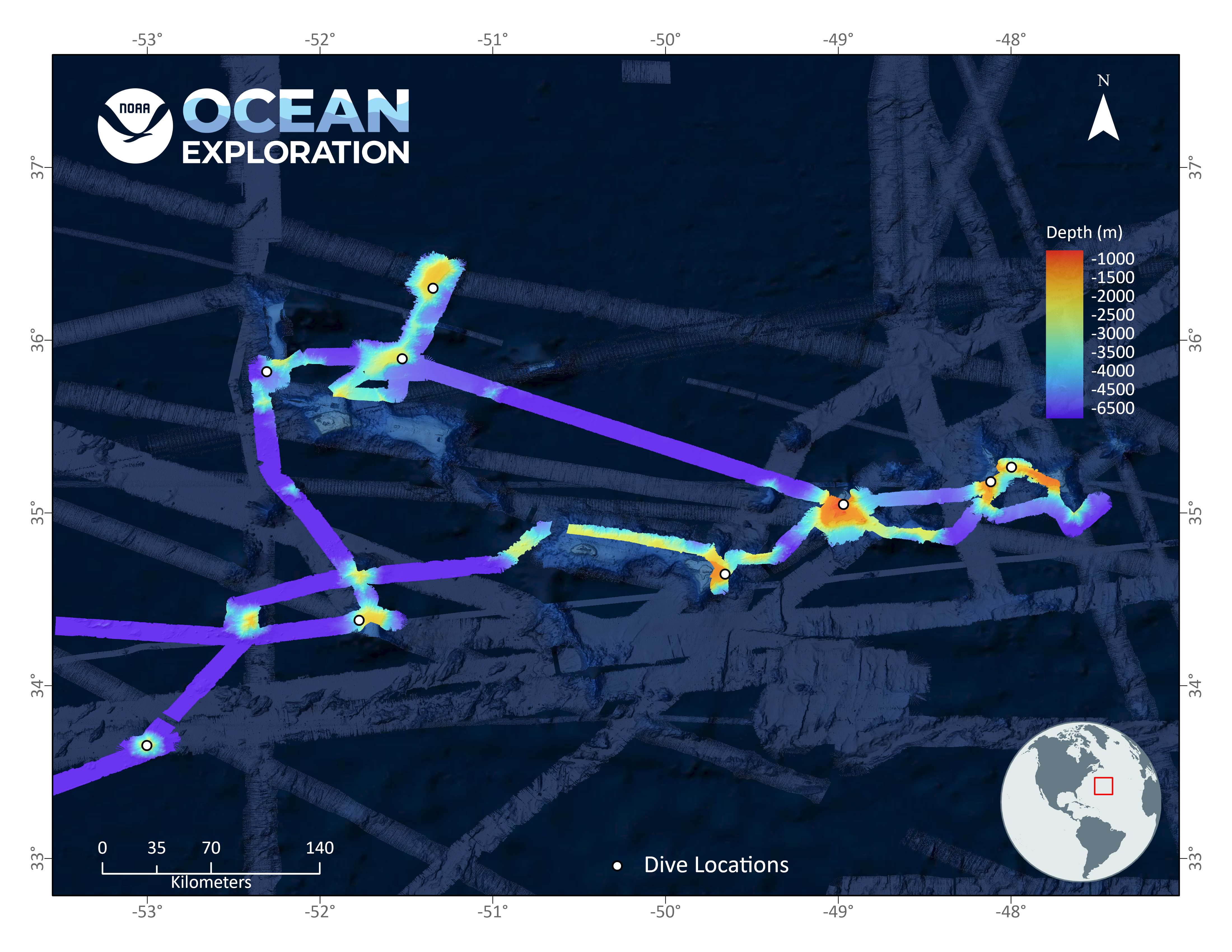
Map showing the bathymetric data collected around the Corner Rise Seamounts during the 2021 North Atlantic Stepping Stones expedition. Much of this area had not been mapped at all prior to the expedition, and in addition to providing critical information needed to successfully plan expedition dives, this mapping data contributes to our overall understanding of the seafloor.