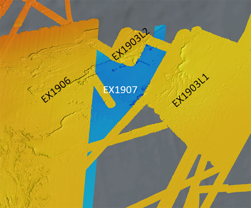
Taking advantage of weather days during the 2019 Southeastern U.S. Deep-sea Exploration (EX1907), the Mapping Team was able to fill in an unmapped area and merge it with mapping data from three previous NOAA Ship Okeanos Explorer missions in the region: Windows to the Deep 2019 legs one and two (EX1903L1 and EX1903L2) and the first part of the 2019 Southeastern U.S. Deep-sea Exploration (EX1906).
Bathymetry
Image courtesy of the NOAA Office of Ocean Exploration and Research. Download image (jpg, 82 KB).
Taking advantage of weather days during the 2019 Southeastern U.S. Deep-sea Exploration (EX1907), the Mapping Team was able to fill in an unmapped area and merge it with mapping data from three previous NOAA Ship Okeanos Explorer missions in the region: Windows to the Deep 2019 legs one and two (EX1903L1 and EX1903L2) and the first part of the 2019 Southeastern U.S. Deep-sea Exploration (EX1906).
Learn more