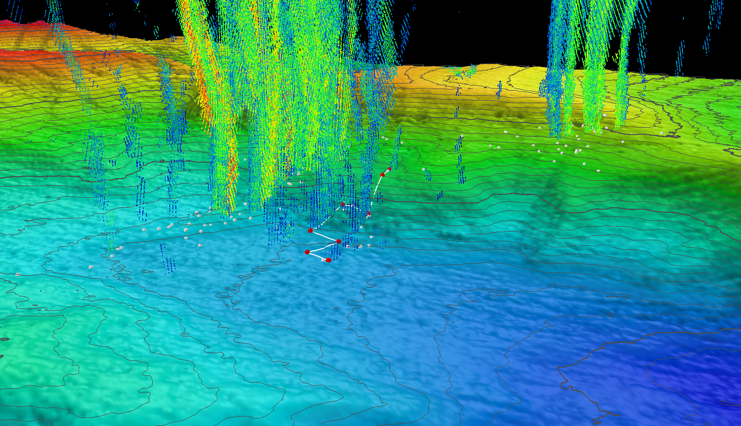
Plumes
Three-dimensional perspective of a ROV Deep Discoverer dive track (white lines) and waypoints (red points) with superposed water column bubble plumes (multi-colored point clouds) imaged by NOAA Ship Okeanos Explorer during a previous mission. Methane bubble plumes at Norfolk Seeps have been imaged rising over 900 meters (2,950 feet) above the seafloor in previous surveys. Bathymetric data were collected with the Okeanos Explorer multibeam sonar and are contoured at 10-meter (about 3-feet) intervals. The locations of previously identified seeps are indicated with white points. All data are shown at two times vertical exaggeration.
 and waypoints (red points) with superposed water column bubble plumes (multi-colored point clouds) imaged by NOAA Ship Okeanos Explorer during a previous mission. Methane bubble plumes at Norfolk Seeps have been imaged rising over 900 meters (2,950 feet) above the seafloor in previous surveys. Bathymetric data were collected with the Okeanos Explorer multibeam sonar and are contoured at 10-meter (about 3-feet) intervals. The locations of previously identified seeps are indicated with white points. All data shown at two times vertical exaggeration.")