The Northeast Canyons and Seamounts Marine National Monument
Image courtesy of James Gardner, The Center for Coastal and Ocean Mapping, Joint Hydrographic Center, University of New Hampshire.Download larger version (jpg, 1.1 MB).
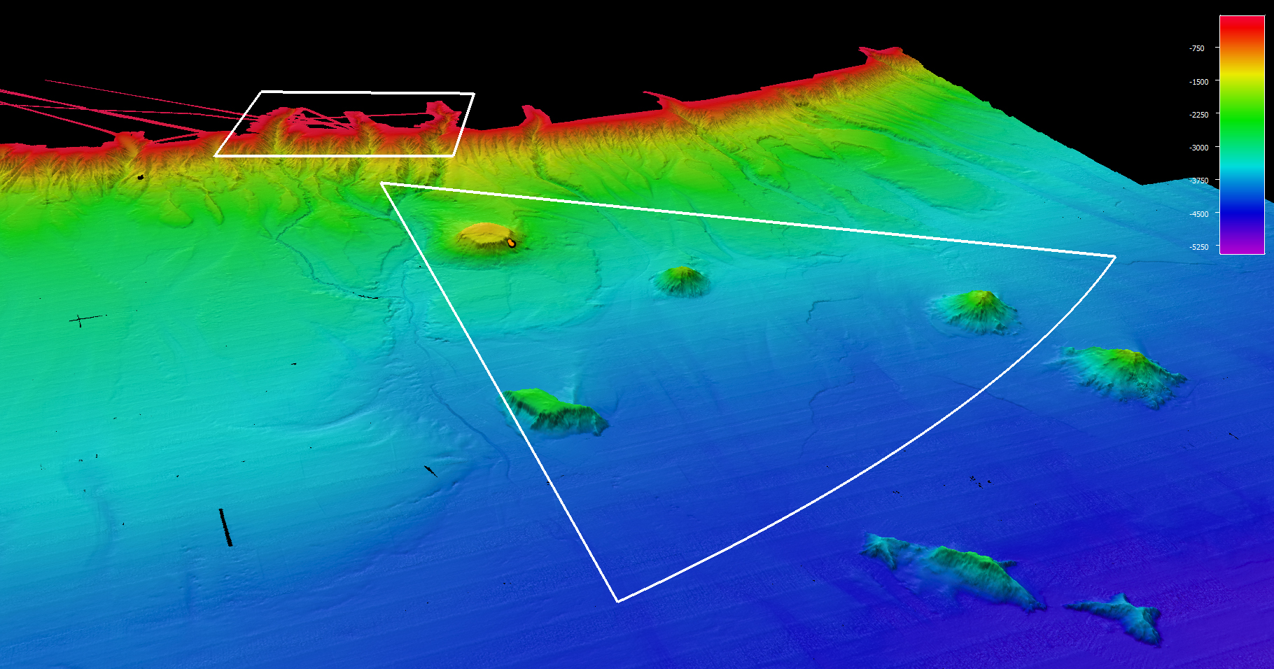
Map of the Northeast Canyons and Seamounts Marine National Monument. The rectangular shape to the left is the canyons unit, while the triangular shape below is the seamounts unit, where dive 8 of the Deep Connections 2019 expedition occurred.
