SEDCI Map
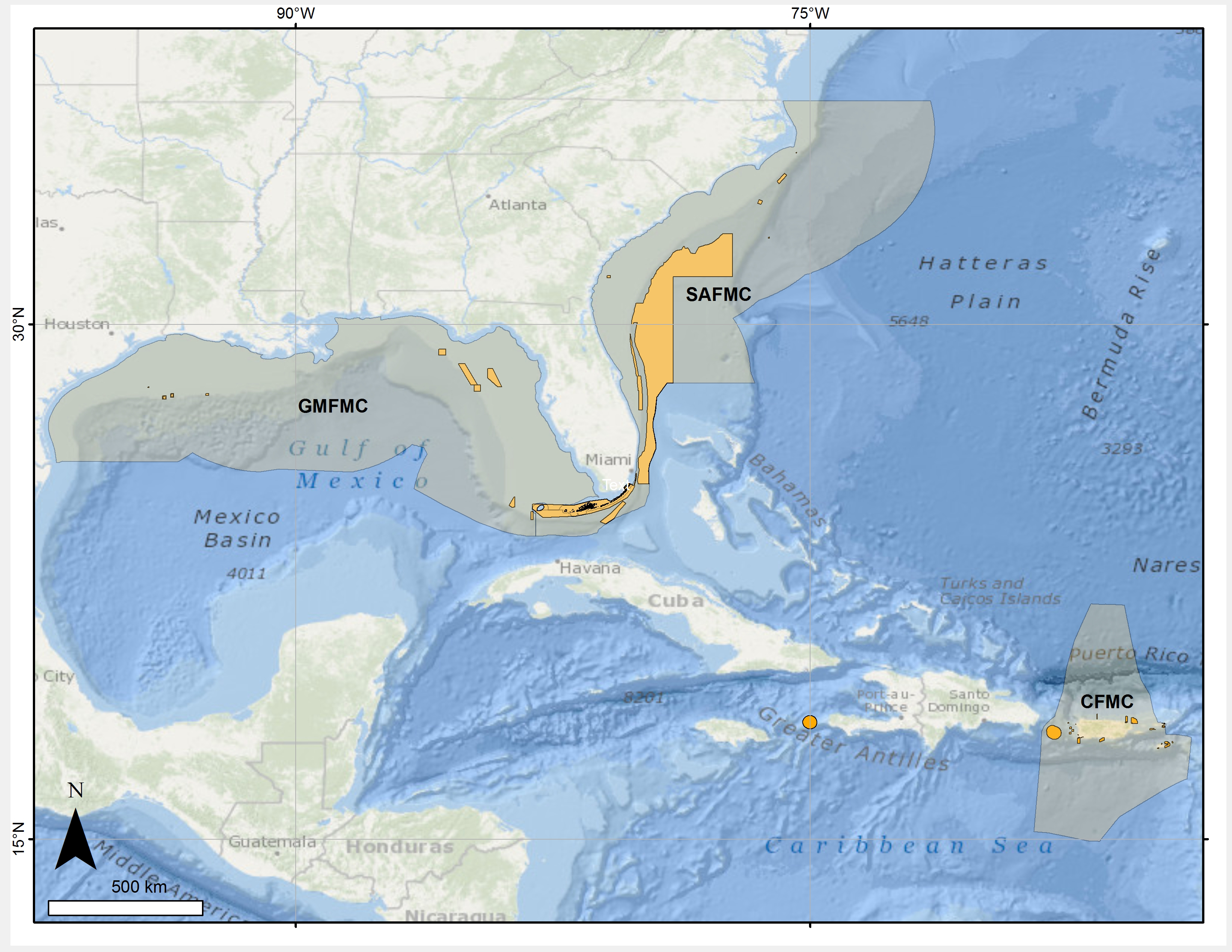
Map showing the geographic regions in which the Southeast Deep Coral Initiative (SEDCI) will operate in 2016-2019. This area corresponds to the jurisdiction of three fishery management councils, including Gulf of Mexico, South Atlantic and Caribbean fishery management councils (GMFMC, SAFMC, CFMC), shown in gray. Areas where deep-sea habitats are protected through fishing restrictions are shown in orange.
 will operate in 2016-2019. This area corresponds to the jurisdiction of three fishery management councils, including Gulf of Mexico, South Atlantic and Caribbean fishery management councils (GMFMC, SAFMC, CFMC), shown in gray. Areas where deep-sea habitats are protected through fishing restrictions are shown in orange.")