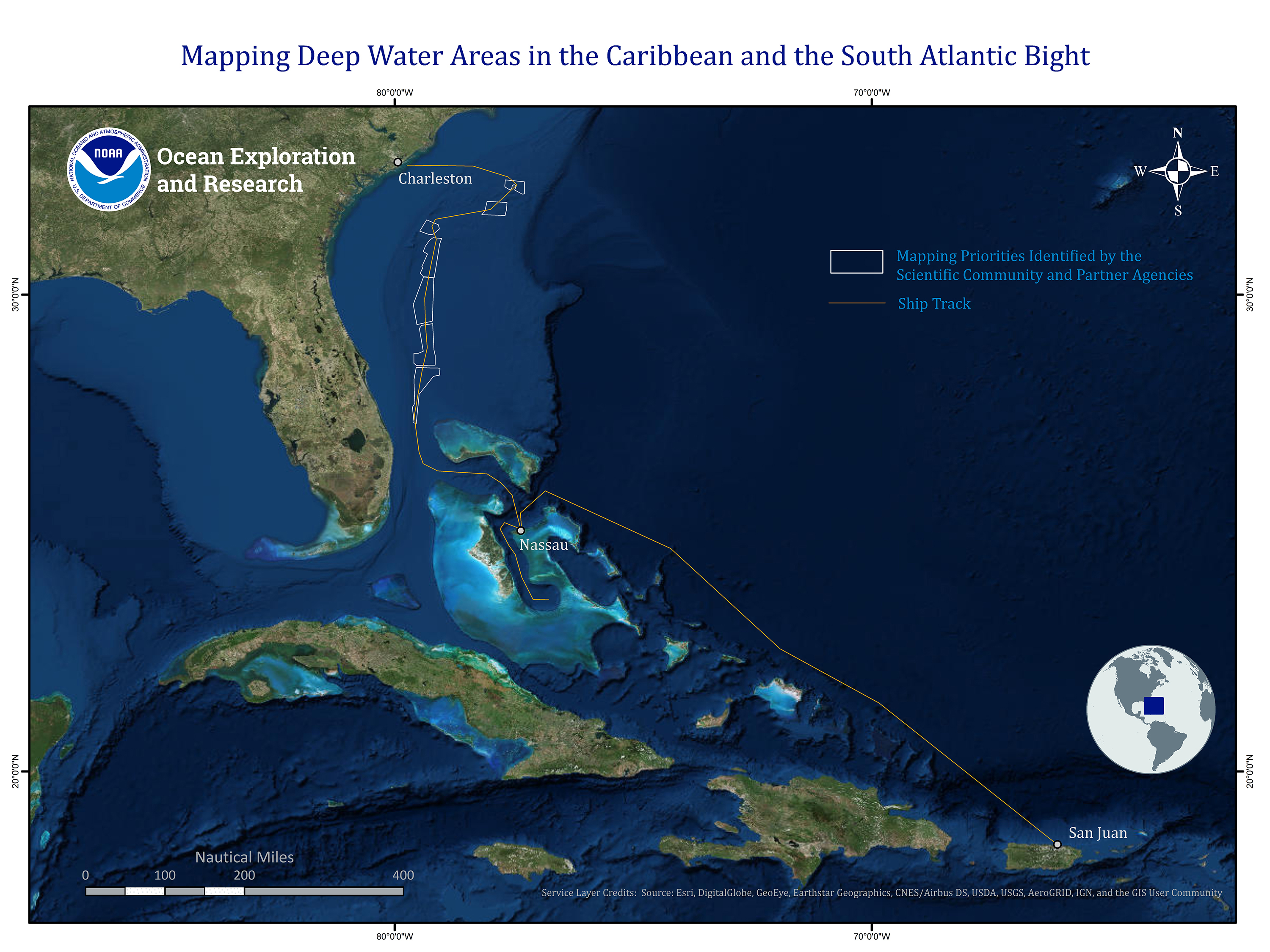
Image courtesy of the NOAA Office of Ocean Exploration and Research, Mapping Deepwater Areas in the Caribbean and South Atlantic Bight.Download larger version (jpg, 2.3 MB).
Map showing the planned route of NOAA Ship Okeanos Explorer, shown in yellow, and the planned operations area for the expedition, outlined in white.
