NOAA Ship Okeanos Explorer mapped 800 square kilometers (309 square miles) of unmapped seafloor in this ASPIRE priority area. This was identified by scientists and community partners about a month prior to the expedition at the NOAA OER-hosted ASPIRE Science Planning workshop.
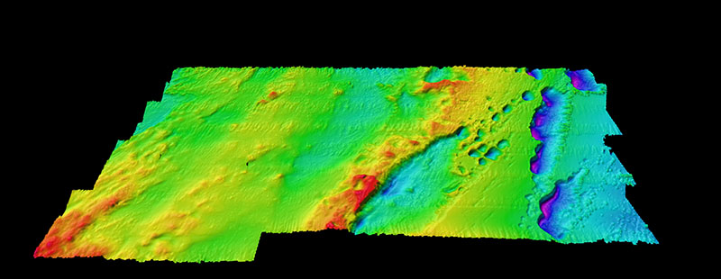
Previously Unmapped Seafloor in Priority Area
Image courtesy of the NOAA Office of Ocean Exploration and Research, Mapping Deepwater Areas in the Caribbean and South Atlantic Bight. Download larger version (jpg, 3.7 MB).
NOAA Ship Okeanos Explorer mapped 800 square kilometers (309 square miles) of unmapped seafloor in this ASPIRE priority area. This was identified by scientists and community partners about a month prior to the expedition at the NOAA OER-hosted ASPIRE Science Planning workshop.
Learn more