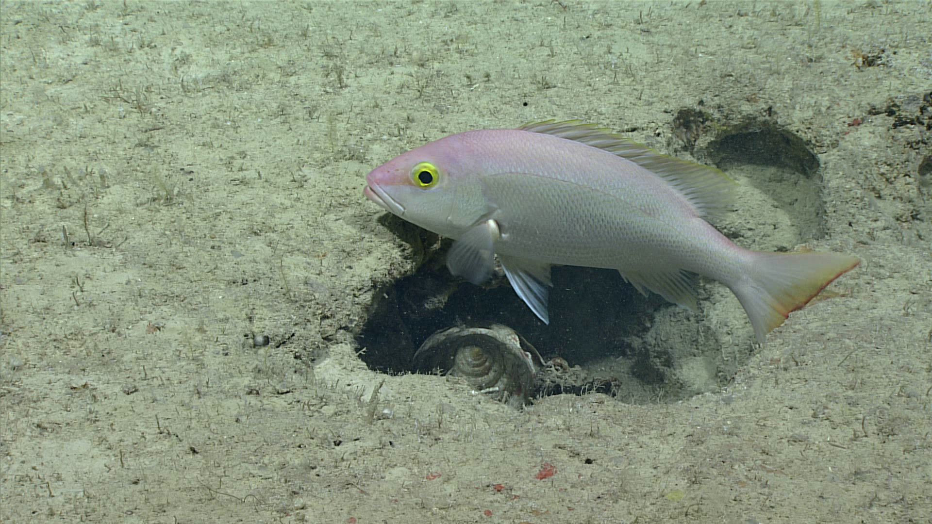
Silk snapper (Lutjanus vivanus) with a possible gastropod in the crevice. Image courtesy of the NOAA Office of Ocean Exploration and Research, Exploring Deep-sea Habitats off Puerto Rico and the U.S. Virgin Islands.Download larger version (jpg, 959 KB).
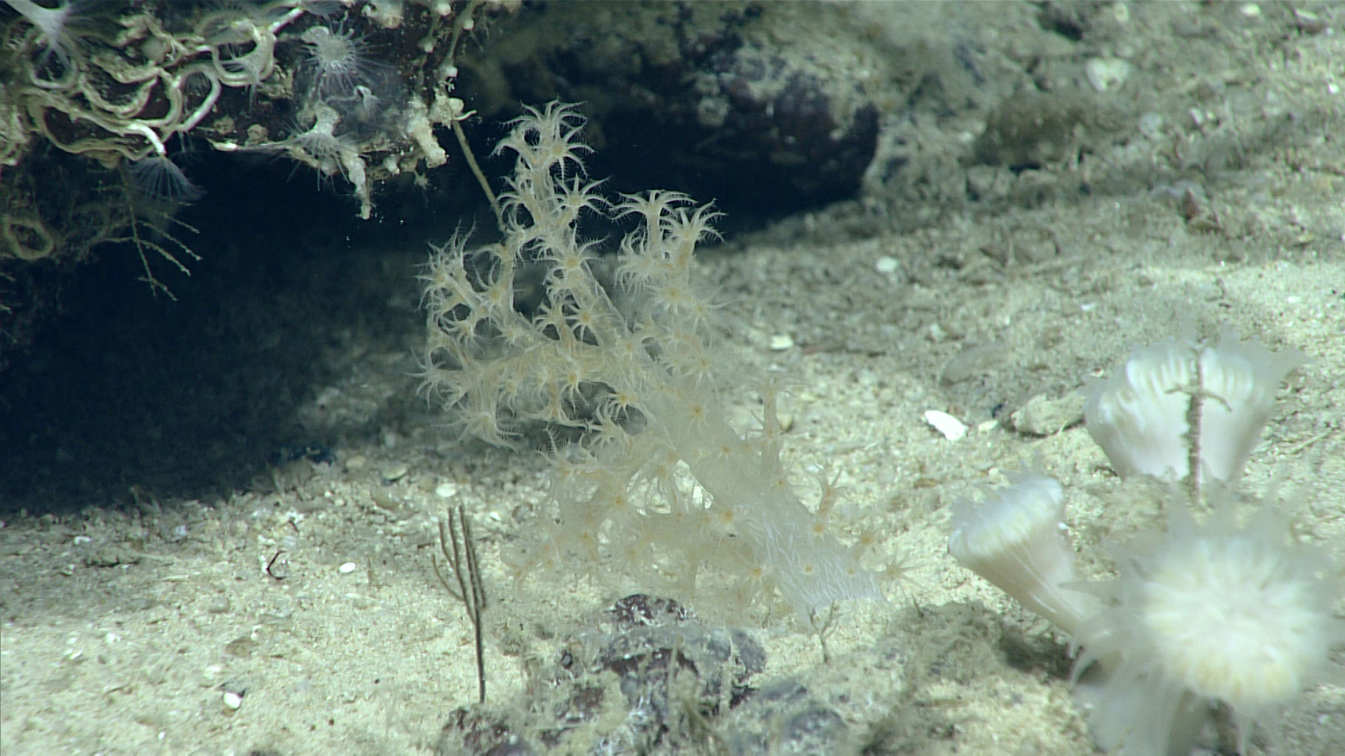
True soft coral with small cup corals in the bottom right. Image courtesy of the NOAA Office of Ocean Exploration and Research, Exploring Deep-sea Habitats off Puerto Rico and the U.S. Virgin Islands.Download larger version (jpg, 936 KB).
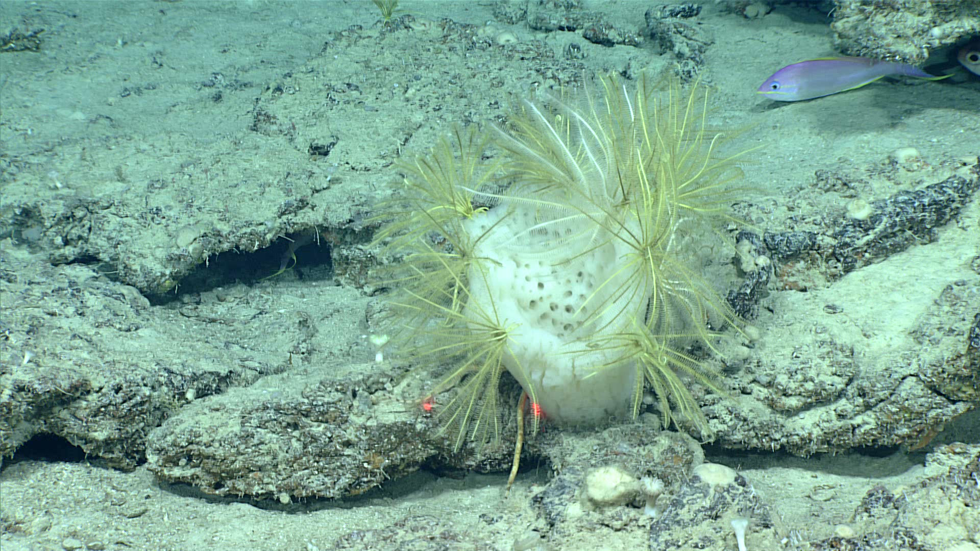
Glass sponge with crinoids gathered along its osculum. The two laser points are used for scale; they are 10 centimeters (about 4 inches) apart. Image courtesy of the NOAA Office of Ocean Exploration and Research, Exploring Deep-sea Habitats off Puerto Rico and the U.S. Virgin Islands.Download larger version (jpg, 1.3 MB).
At the end of Dive 1, we encountered this octopus scooting along the seafloor. Also shown are cup corals and crinoids. Image courtesy of the NOAA Office of Ocean Exploration and Research, Exploring Deep-sea Habitats off Puerto Rico and the U.S. Virgin Islands.Download larger version (jpg, 1.0 MB).
This video features a neck crab documented during Dive 1 of the Océano Profundo 2018 expedition. Neck crabs get their common name because the body is constricted just posterior to the eyes. All of the neck crabs used to be in the genus Podochela, but this genus has recently been split up. The crab in this video might be Coryrhynchus sidneyi, which uses ascidians (group of tunicates) to decorate itself. The ascidians may later grow and help to camouflage the crab. Notice the extended first walking leg of the crab in the video, which crabs of the spider crab group (superfamily Majoidea) use almost like an antenna.
Text contributed by Mary Wicksten, Texas A&M University.
Video courtesy of the NOAA Office of Ocean Exploration and Research, Exploring Deep-sea Habitats off Puerto Rico and the U.S. Virgin Islands.Download larger version (mp4, 39.8 MB).
NOAA Ship Okeanos Explorer arrived at the first exploration site off East Vieques Island in the morning. The team conducted a calibration of the remotely operated vehicle (ROV) positioning system during the first half of the day. Once calibration was complete, the team proceeded to conduct the first ROV dive of the expedition. ROVs reached the seafloor at around 2:00 PM AST, at a depth of 275 meters (902 feete), and successfully explored the seafloor for about two hours. The objective of this dive was to explore commercially important deepwater fish habitats, and we were not disappointed. We captured video footage of large schools of silk snappers, vermillion snappers, and misty groupers. We also observed various invertebrate organisms such as black coral, crinoids, and gastropods scattered along the seafloor in a completely unexplored region of the Caribbean. The seafloor substrate throughout the dive was relatively hard and lightly sedimented with the occasional cobble-sized stones, carbonate outcroppings, and ledges. Over 20 scientists on shore participated throughout the dive, including several that joined from the newly established Exploration Command Center at the EcoExploratorio Science Museum in San Juan, Puerto Rico.
Overnight, the mapping team conducted mapping operations to the south of the first dive site before returning to the general area for another ROV dive the next day. Dive 2 will focus on exploring another site east of Vieques Island at 748-463 meters (2,545-1,519 feet) depth for hard-bottom communities such as deepwater fish species, particularly snappers and groupers, as well as deep-sea corals, sponges, and other bottom-dwelling fauna.
Biological Oceanographer, Aurea Rodriguez Santiago (Taller Ecologico de Puerto Rico), participates in the first ROV dive of the Océano Profundo 2018 expedition from the newly established exploration command center (ECC) at the EcoExploratorio Science Museum in San Juan, Puerto Rico. This new EEC is being sponsored by the Tennenbaum Exploration Initiative and the Soul of Bahia Foundation. Image courtesy of the NOAA Office of Ocean Exploration and Research, Exploring Deep-Sea Habitats off Puerto Rico and the U.S. Virgin Islands.Download larger version (jpg, 1.5 MB).
The team conducting a calibration of the ROV positioning system. Image courtesy of Art Howard, GFOE, Exploring Deep-sea Habitats off Puerto Rico and the U.S. Virgin Islands.Download larger version (jpg, 6.1 MB).
 with a possible gastropod in the crevice.")

 apart.")

, participates in the first ROV dive of the Océano Profundo 2018 expedition from the newly established exploration command center (ECC) at the EcoExploratorio Science Museum in San Juan, Puerto Rico. This new EEC is being sponsored by the Tennenbaum Exploration Initiative and the Soul of Bahia Foundation. Image courtesy of the NOAA Office of Ocean Exploration and Research, Exploring Deep-Sea Habitats off Puerto Rico and the U.S. Virgin Islands.")


