-
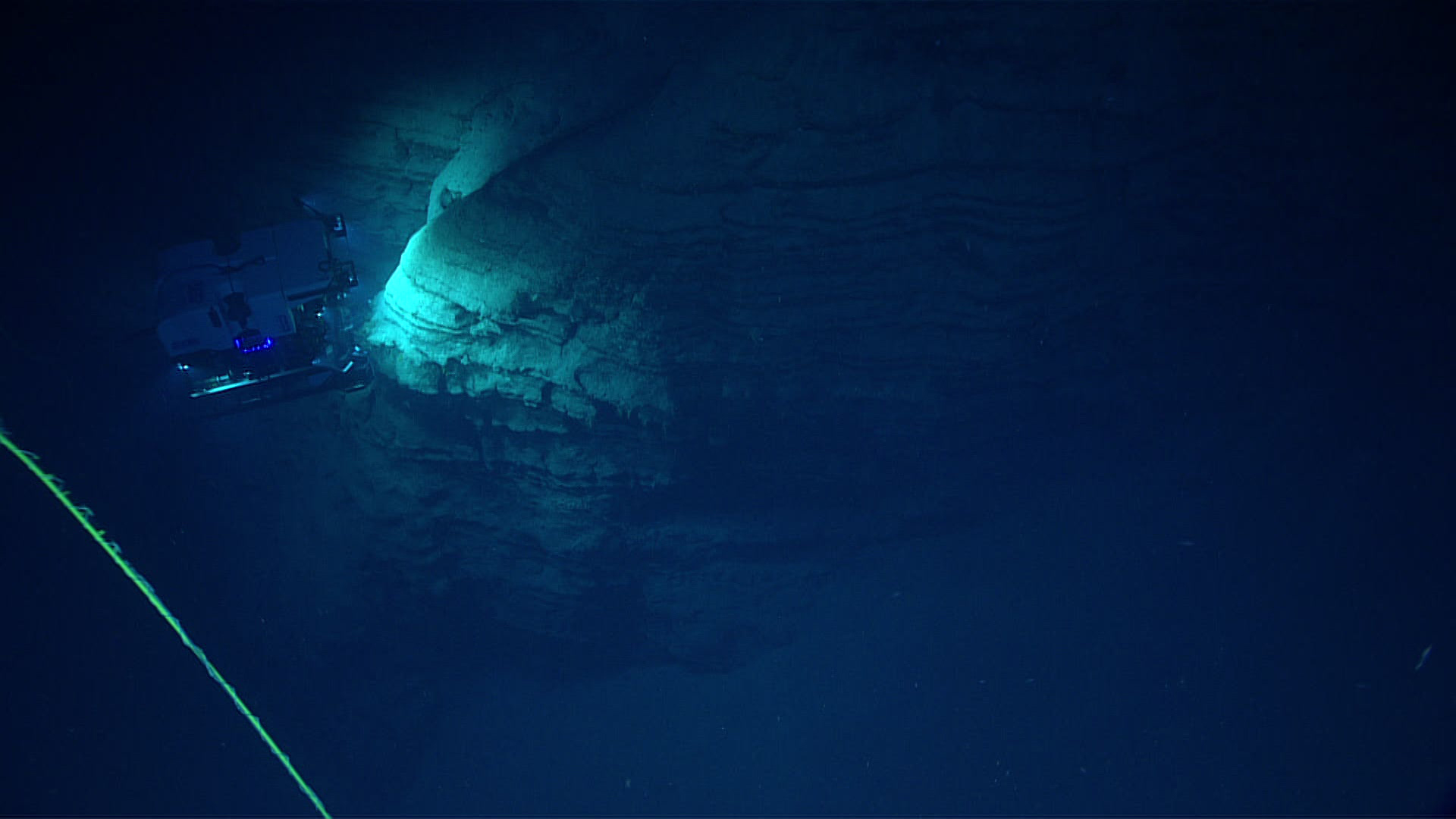
 depth, which included dramatic vertical walls that were good habitat for a variety of corals and sponges.")
During Dive 4, we explored an amphitheater-like feature at 450-564 meters (1,476-1,850 feet) depth, which included dramatic vertical walls that were good habitat for a variety of corals and sponges. Image courtesy of the NOAA Office of Ocean Exploration and Research, Exploring Deep-sea Habitats off Puerto Rico and the U.S. Virgin Islands. Download larger version (jpg, 407 KB).
-

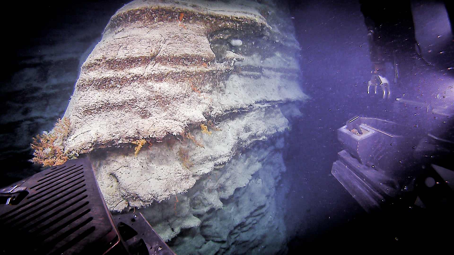
The exposed carbonate walls with undercut ledges provided good habitat for a diversity of deep-sea corals. Image courtesy of the NOAA Office of Ocean Exploration and Research, Exploring Deep-sea Habitats off Puerto Rico and the U.S. Virgin Islands. Download larger version (jpg, 1.3 MB).
-

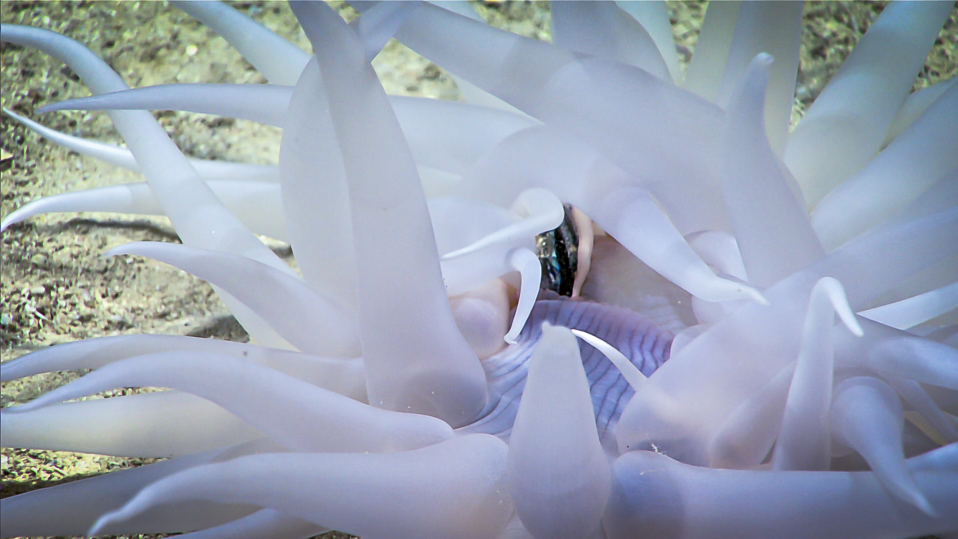
This deep-sea anemone was filmed in the process of eating a small midwater fish, a valuable observation since very little is known about the basic biology and ecology of most deepwater species. Image courtesy of the NOAA Office of Ocean Exploration and Research, Exploring Deep-sea Habitats off Puerto Rico and the U.S. Virgin Islands. Download larger version (jpg, 1.1 MB).
-
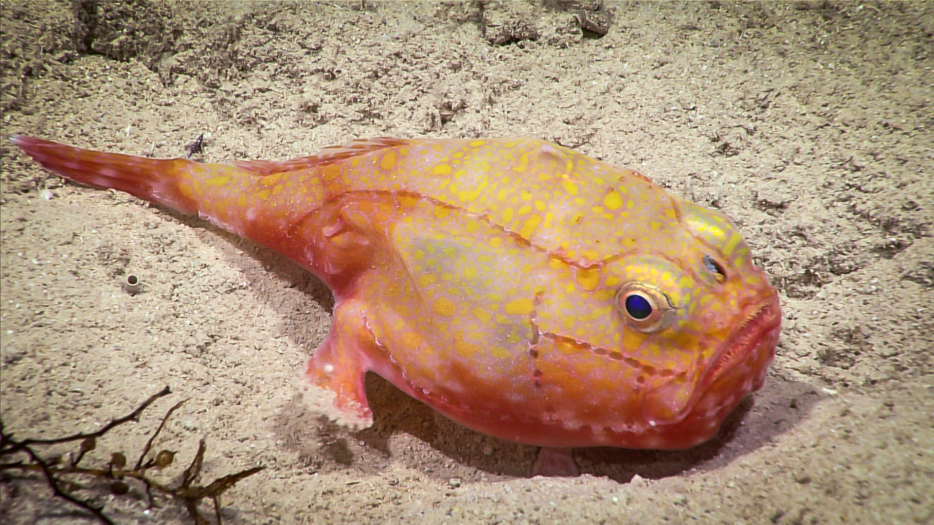
 is an ambush predator that lies on the seafloor waiting for prey to pass by, then opens its mouth to suck in its meal. Toadfish use modified fins to walk along the seafloor, but can also swim using their caudal fin.")
This toadfish (Chaunax sp.) is an ambush predator that lies on the seafloor waiting for prey to pass by, then opens its mouth to suck in its meal. Toadfish use modified fins to walk along the seafloor, but can also swim using their caudal fin. Image courtesy of the NOAA Office of Ocean Exploration and Research, Exploring Deep-sea Habitats off Puerto Rico and the U.S. Virgin Islands. Download larger version (jpg, 1.9 MB).

