-

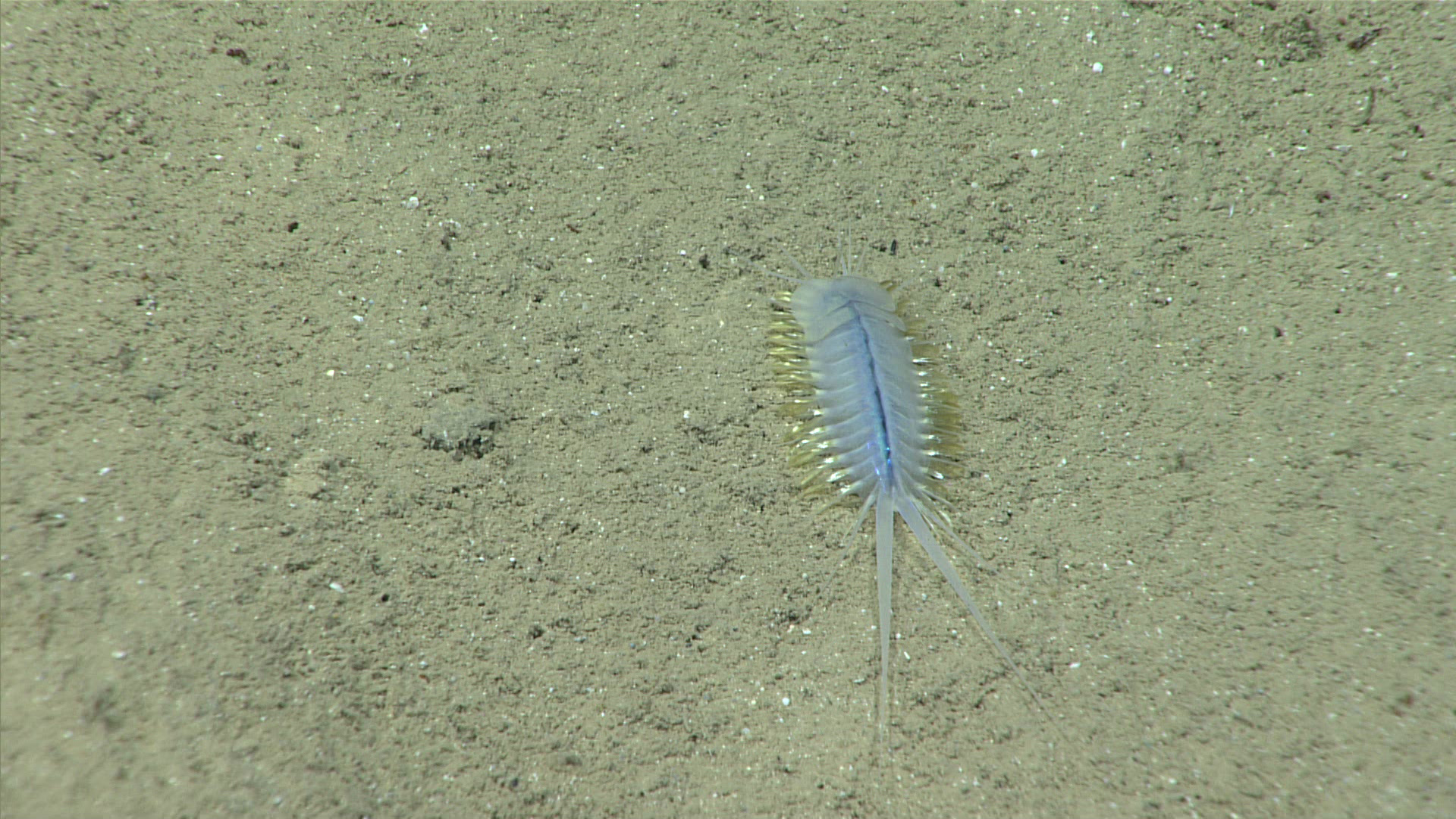
Polynoid worm seen on soft sediments at the beginning of Dive 19. Image courtesy of the NOAA Office of Ocean Exploration and Research, Exploring Deep-sea Habitats off Puerto Rico and the U.S. Virgin Islands. Download larger version (jpg, 1.3 MB).
-

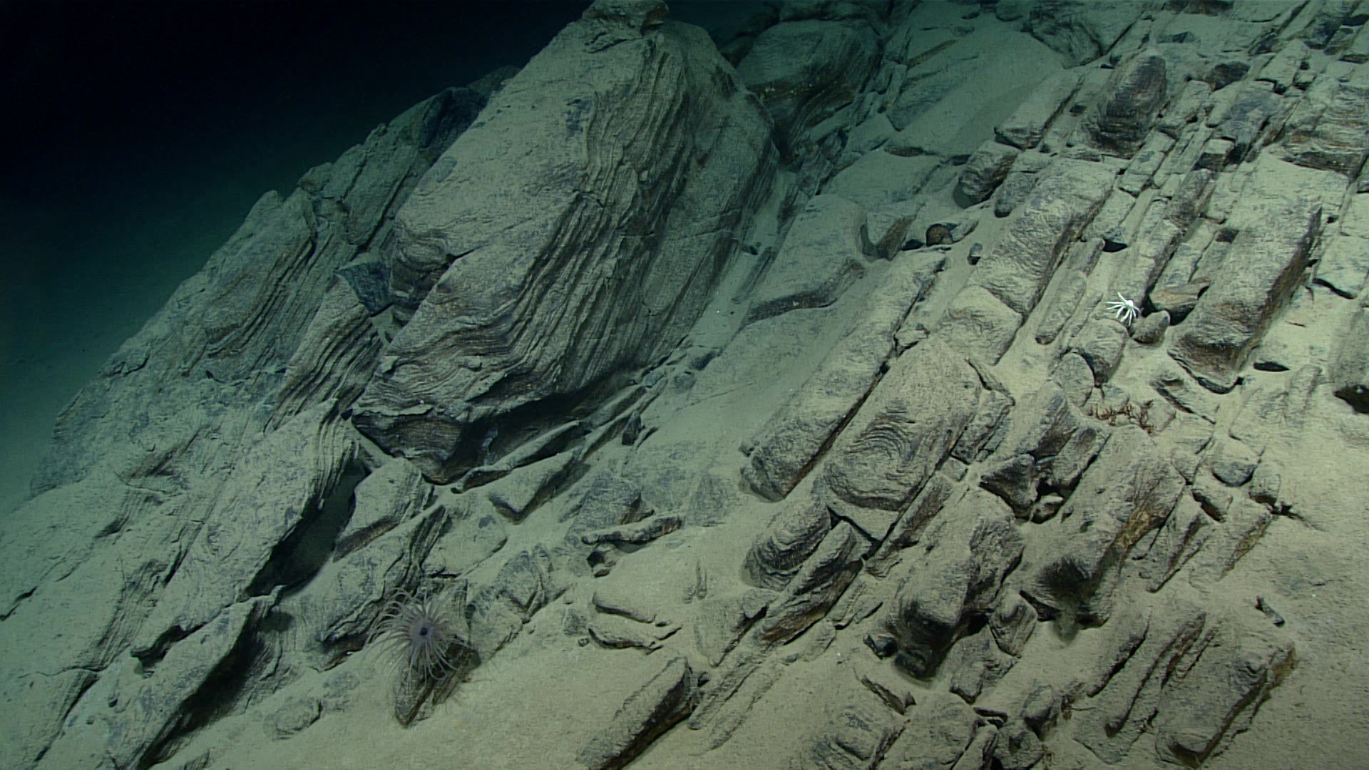
Geological bedforms were observed over steep rocky slopes explored during Dive 19. These formations were often cracked and full of loose debris. Image courtesy of the NOAA Office of Ocean Exploration and Research, Exploring Deep-sea Habitats off Puerto Rico and the U.S. Virgin Islands. Download larger version (jpg, 1.2 MB).
-

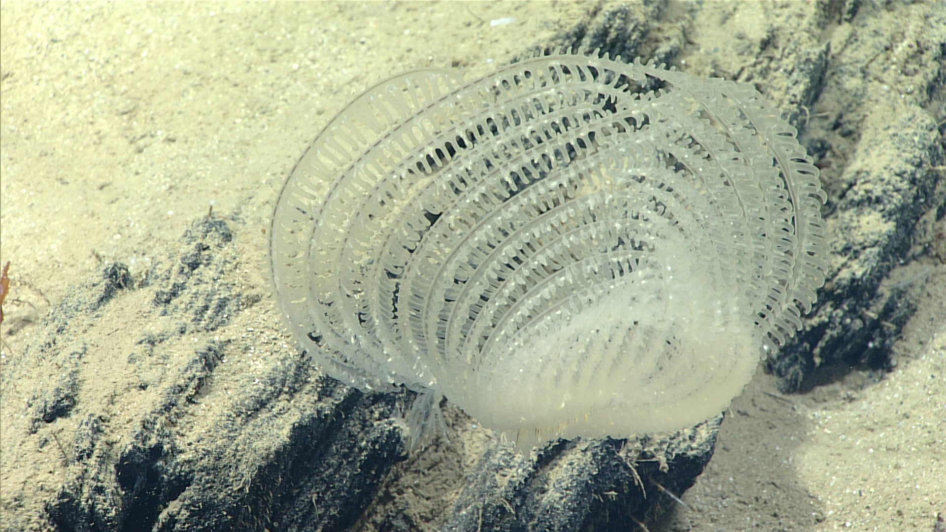
The black coral Abyssopathes cf. lyra was one of only two species of corals observed on this dive. The black coral genus Abyssopathes is among the deepest-dwelling corals known to occur. Image courtesy of the NOAA Office of Ocean Exploration and Research, Exploring Deep-sea Habitats off Puerto Rico and the U.S. Virgin Islands. Download larger version (jpg, 1.3 MB).
-

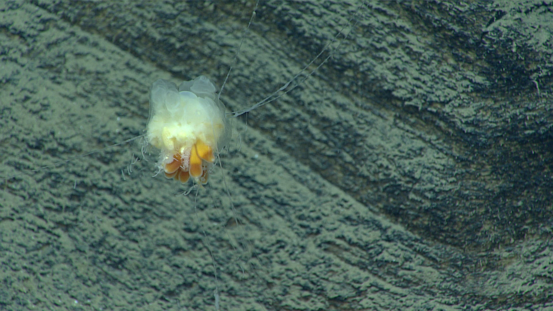
Dandelion siphonophore seen near the end of Dive 19. Image courtesy of the NOAA Office of Ocean Exploration and Research, Exploring Deep-sea Habitats off Puerto Rico and the U.S. Virgin Islands. Download larger version (jpg, 1.1 MB).

