-

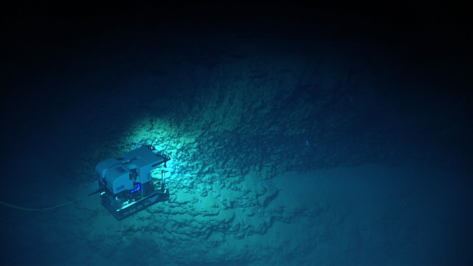
Remotely operated vehicle Deep Discoverer exploring the geology of exposed rocks on a landslide scarp north of Vega Baja on the north shore of Puerto Rico. Image courtesy of the NOAA Office of Ocean Exploration and Research, Exploring Deep-sea Habitats off Puerto Rico and the U.S. Virgin Islands. Download larger version (jpg, 439 KB).
-

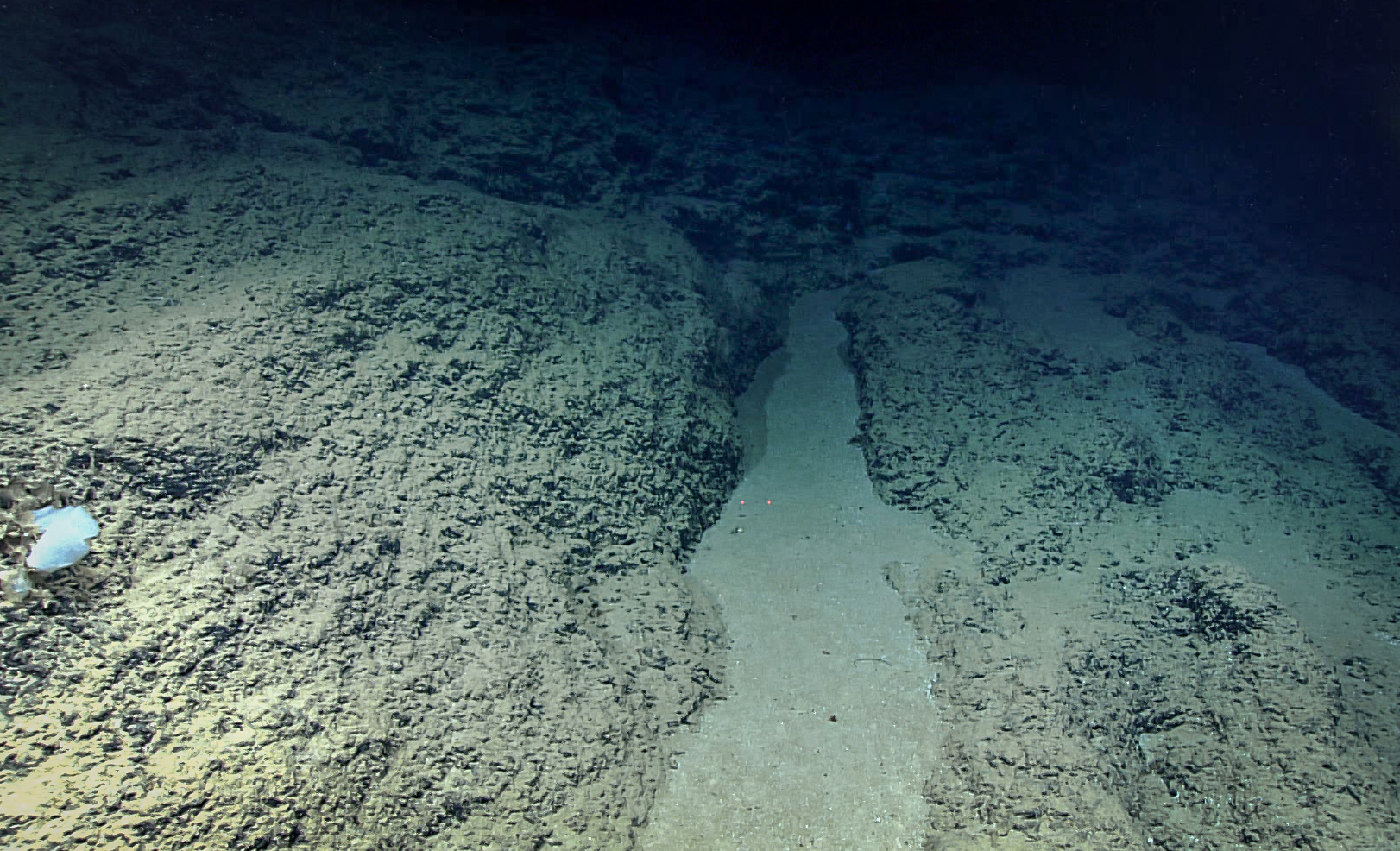
The substrate consisted mostly of ferromanganese-coated rocks draped heavily with soft sediment. Image courtesy of the NOAA Office of Ocean Exploration and Research, Exploring Deep-sea Habitats off Puerto Rico and the U.S. Virgin Islands. Download larger version (jpg, 1.5 MB).
-
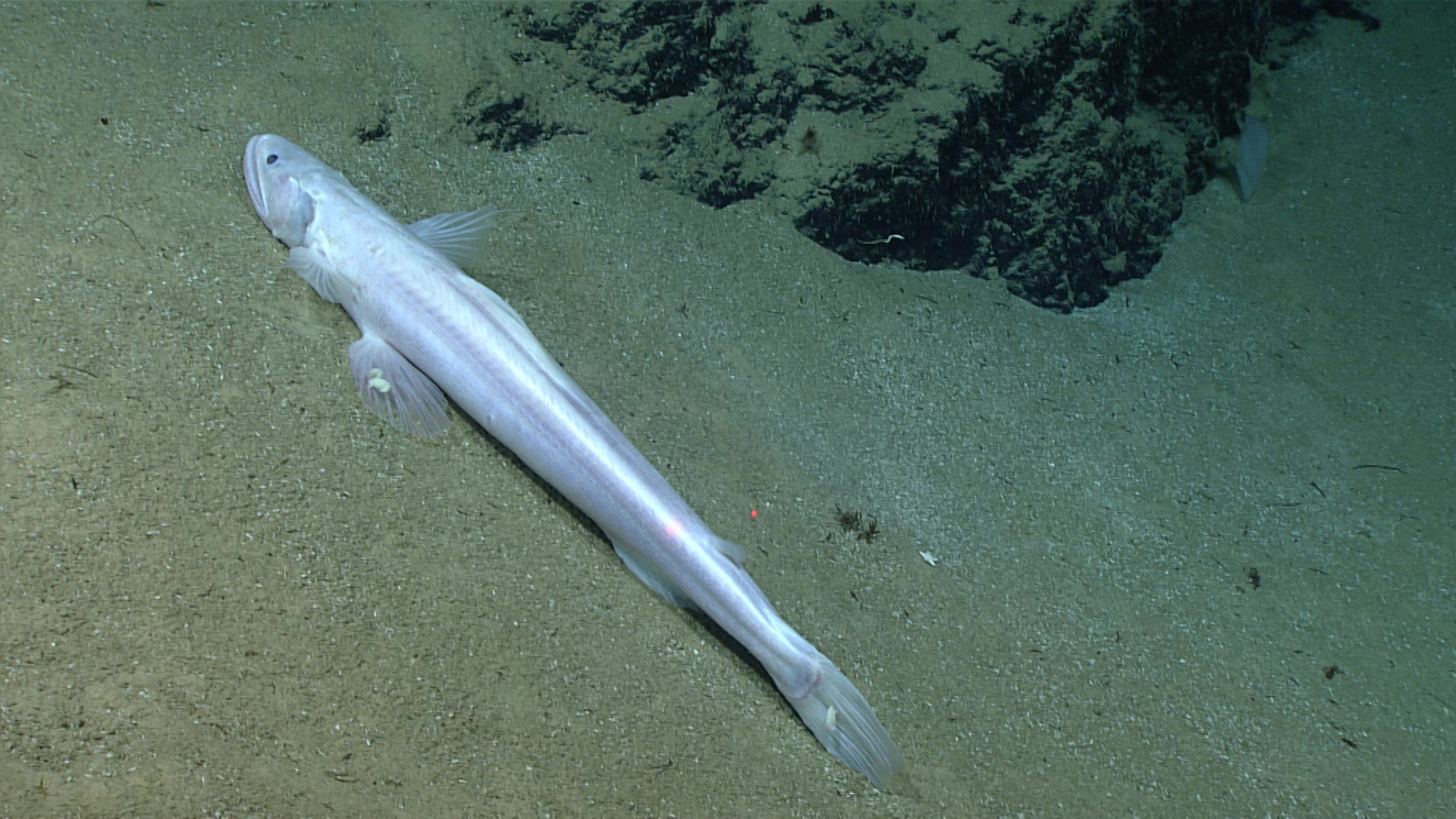
 Bathysaurus sp. fish throughout the dive, including this individual with parasitic . amphipods on its caudal and pectoral fins.")
We saw two very large (>1 meter) Bathysaurus sp. fish throughout the dive, including this individual with parasitic amphipods on its caudal and pectoral fins. Image courtesy of the NOAA Office of Ocean Exploration and Research, Exploring Deep-sea Habitats off Puerto Rico and the U.S. Virgin Islands. Download larger version (jpg, 1.3 MB).
-

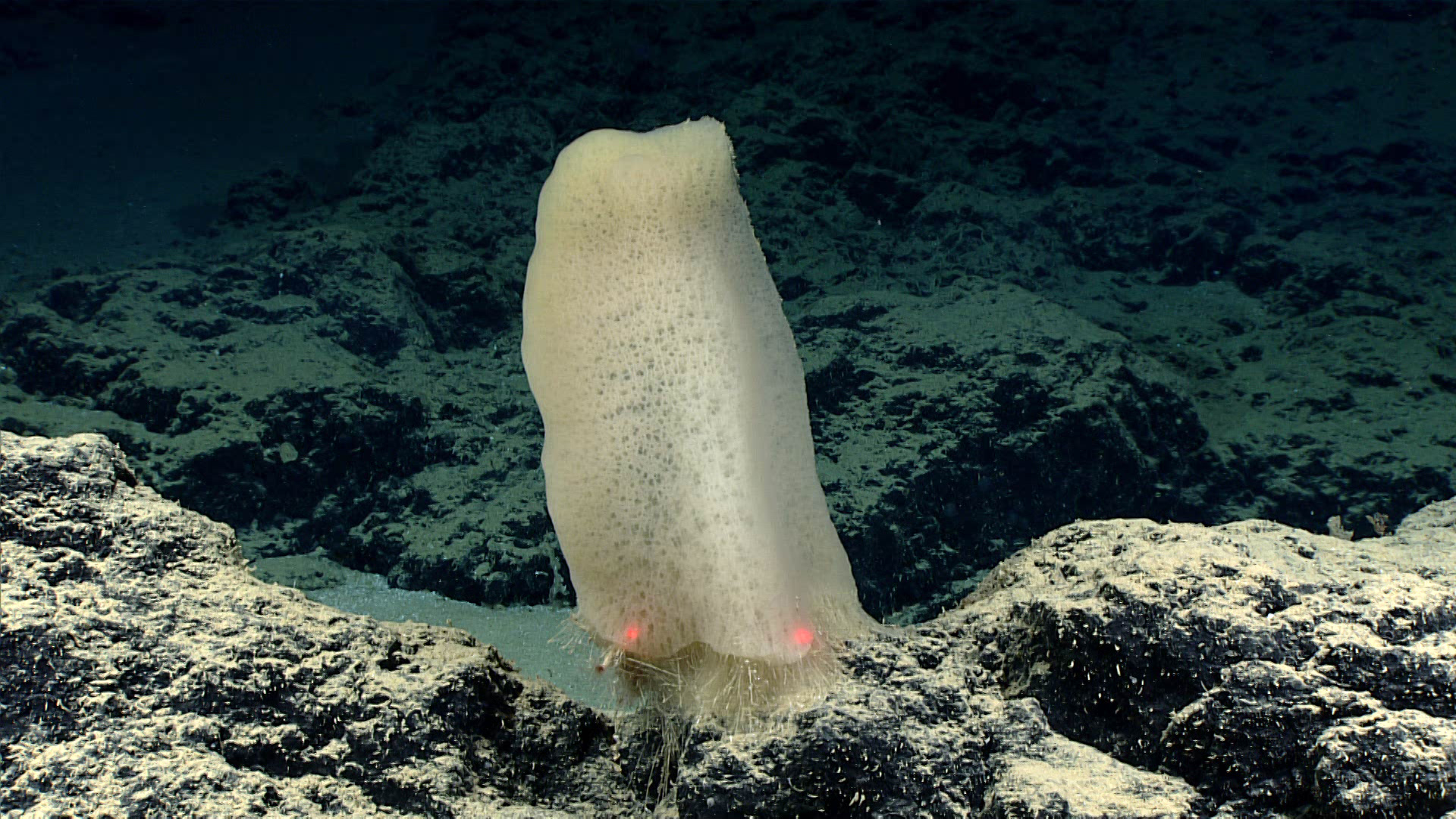
Glass sponge at a depth of 3,400 meters (2.1 miles). The sponge looks very similar to Poliopogon cf. amadou, which has been reported from the mid and eastern North Atlantic at similar depths, but has not yet been identified from the Caribbean. A sample of this sponge was collected, as it may represent a substantial range extension. Image courtesy of the NOAA Office of Ocean Exploration and Research, Exploring Deep-sea Habitats off Puerto Rico and the U.S. Virgin Islands. Download larger version (jpg, 1.4 MB).

