Terraced Features
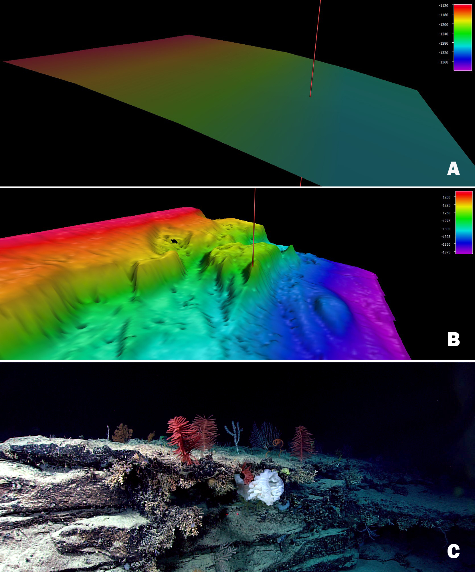
Prior to the Windows to the Deep 2018 expedition, this section of the Blake Escarpment appeared to be an area of low slope with no distinct features based on satellite altimetry. Image A shows satellite altimetry (Smith and Sandwell, 2014) at the Dive 04 site on “Blake Escarpment South.” During the expedition, multibeam mapping revealed a series of terraced features (Image B) and ROV exploration (at the site of the red mark) documented a highly diverse and dense community of deep-sea corals and sponges that were observed throughout the dive (Image C).
 at the Dive 04 site on “Blake Escarpment South.” During the expedition, multibeam mapping revealed a series of terraced features (Image B) and ROV exploration (at the site of the red mark) documented a highly diverse and dense community of deep-sea corals and sponges that were observed throughout the dive (Image C).")