Loading the player...
This video, collected during Dive 16 of the expedition, highlights a benthic fish dwelling in a burrow, snatching a large midwater fish with quill worms as onlookers. This remarkable video footage gives us the rare opportunity to document a predation event in the deep sea, while highlighting the trophic links between animals that live in the water column with those that live on the seafloor. Read the full description of the video here.
Video courtesy of the NOAA Office of Ocean Exploration and Research, Windows to the Deep 2018. Download larger version (mp4, 19.5 MB).
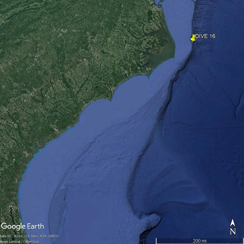
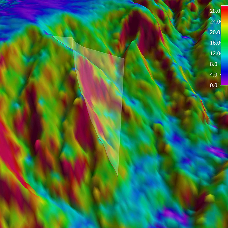
This dive explored the northern wall of an unnamed submarine canyon approximately 25 miles off Pea Island on the Outer Banks of North Carolina. This region was first mapped by NOAA Ship Okeanos Explorer and the U.S. Geological Survey (USGS) which provided high-resolution multibeam data as well as the potential locations of seeps in the area. We planned our dive track to traverse an area with five potential seep targets. These seeps were identified in multibeam data by the reflection off of bubbles coming up from the seafloor. The different density of the bubbles compared to the water allows them to be detected in the water column, and scientists can use these bubble plumes to identify the location of these seeps. Prior to 2010, only about two seeps had been identified along the Atlantic coast. By 2014, a scientific publication (Skarke et al. 2014 ), highlighting work by NOAA Ship Okeanos Explorer, USGS, and partners identified over 500 seeps in the region. Today’s dive verified some of the seep locations by providing video evidence of bubbles emanating from the seafloor in several places where they were expected based upon the multibeam data.
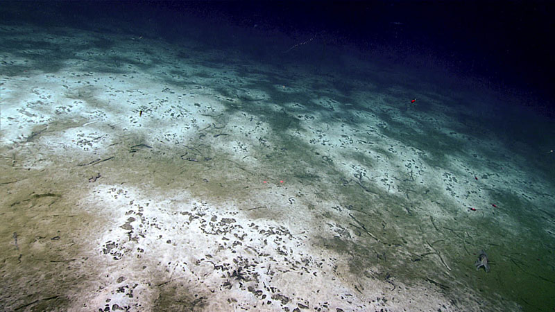
Landscape view of the many bacterial mats seen along the seafloor during Dive 16 of the Windows to the Deep 2018 expedition. Image courtesy of the NOAA Office of Ocean Exploration and Research, Windows to the Deep 2018. Download larger version (jpg, 632 KB).
The remotely operated vehicle (ROV) Deep Discoverer was on the seafloor from 13:17:41 - 20:16:20 UTC. The ROV began the dive at 511 meters (1,677 feet) depth and scaled a canyon ridge, ending the dive at a depth of around 328 meters (1,076 feet). Many quill worms (Hyalinoecia tubicola) were seen throughout the dive on the seafloor. The quill worms were seen carrying their tubes along the seafloor and feeding in clusters. During the dive, scientists witnessed predation events including a midshipman fish emerging from a burrow to eat a squid and tube anemones eating a siphonophore and amphipods. Other species seen during the dive included batfish, hagfish, eelpouts, rat tails, flatfish, southern hake, silver hake, gastropods, hermit crabs, spider crabs, Cancer crabs, sea stars, and many animals in the water column including viperfish, amphipods, krill, jellies, and squid. The squid Brachioteuthis was observed sitting on the bottom – a rare sighting. Scientists collected several samples, including a sediment sample that included a snail, two quill worms, and water samples for eDNA or environmental DNA analysis. Once available, review the dive summary for more information about the dive and the collections obtained.
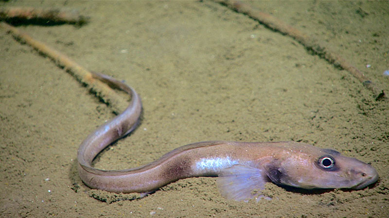
An eelpout seen during Dive 16 of the Windows to the Deep 2018 expedition. Quill worm tubes can be seen in the background of this image. These were two of the most common fauna observed during this dive. Image courtesy of the NOAA Office of Ocean Exploration and Research, Windows to the Deep 2018. Download larger version (jpg, 548 KB).
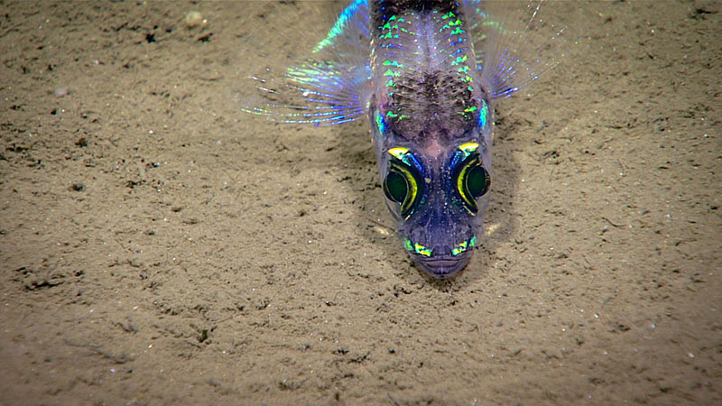
A greeneye fish seen on the seafloor during Dive 16 of the Windows to the Deep 2018 expedition. Image courtesy of the NOAA Office of Ocean Exploration and Research, Windows to the Deep 2018. Download larger version (jpg, 686 KB).
Throughout the dive, scientists also observed extensive bacterial mats and several places where bubbles were escaping from the seafloor. Scientists documented the size of the bubbles because size can indicate the bubble’s methane retention, larger bubble retain methane longer transporting more throughout the water column. This methane can be a food source for chemosynthetic fauna and is important in understanding the carbon cycle in the ocean.
With the dive complete, NOAA Ship Okeanos Explorer is preparing for the final dive of the expedition tomorrow at the Currituck Landslide feature. The ship will be mapping overnight in route and will collect valuable sub-bottom profiler data to better understand the subsurface structures along this feature.
