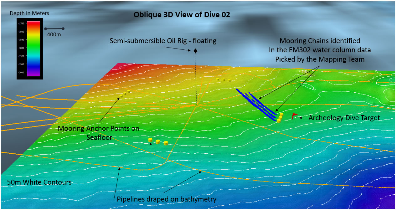
Bathymetric Image
Image courtesy of the NOAA Office of Ocean Exploration and Research, Gulf of Mexico 2018.
Bathymetric image of the semi-submersible oil rig, its mooring anchor points, its mooring chains (identified by the mapping team in the water column data), pipelines, and the marine archaeological dive target.
Download larger version (jpg, 565 KB).
, pipelines, and the marine archaeological dive target.")