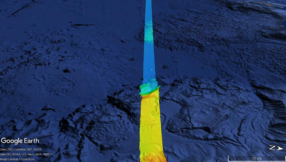
With approximately 95 percent of the ocean unexplored, the NOAA Office of Ocean Exploration and Research pursues every opportunity to map, sample, explore, and survey at planned destinations as well as during transits; "Always Exploring" is a guiding principle. Mapping data is collected at all times when the ship is transiting and underway. This image shows the multibeam bathymetry data acquired during the ship's transit west from Oahu to the Johnston Atoll Unit.
Download larger version (jpg, 332 KB).