-

Map showing the bathymetry data acquired during our July 2017 cruise in the vicinity of “Keli” Ridge and “Edmondson” Seamount. Data collection efforts over several days were designed to complement previous data acquired by R/V Falkor in 2016 and Okeanos Explorer in 2015. Previously acquired datasets are shown as grayscale, and the data acquired this cruise is shown as color bathymetry. Image courtesy of the NOAA Office of Ocean Exploration and Research, 2017 Laulima O Ka Moana. Download larger version (jpg, 243 KB).
-

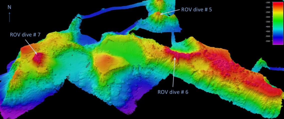
Three-dimensional perspective view of high-resolution bathymetric data in the vicinity of “Keli” ridge; data collected by R/V Falkor in 2016 and by NOAA Ship Okeanos Explorer in 2015 and 2017. Mapping conducted July 19-21, 2017 shows “Keli” ridge, “Edmondson” Seamount, and an unnamed seamount to the west are geologically connected. Image courtesy of the NOAA Office of Ocean Exploration and Research, 2017 Laulima O Ka Moana. Download larger version (jpg, 300 KB).