
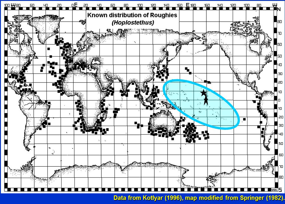
This map shows the distribution of roughies as known to 1996 with small squares. The blue oval shows the vast area of the central Pacific where roughies were unknown. The two stars show the areas of our observations of roughies; the elongate star also includes a site where a pelagic larva had been collected but reported by a different scientific name.