A view of the NOAA Ship Okeanos Explorer mapping track, showing some of the “Mountains in the Deep”. The color bar shows the depth of these features.

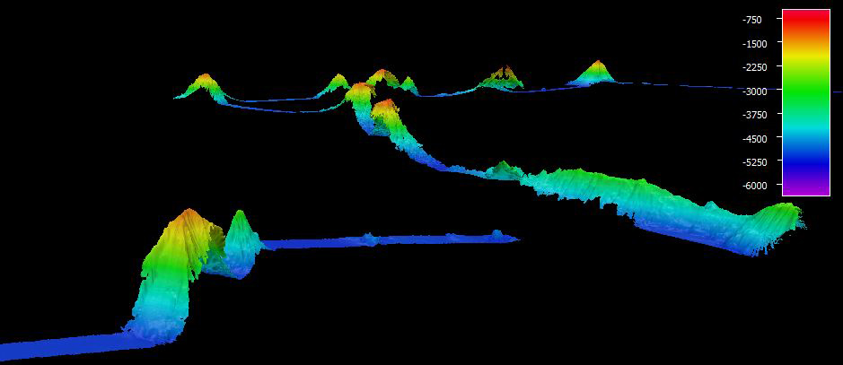
A view of the NOAA Ship Okeanos Explorer mapping track, showing some of the "Mountains in the Deep." The color bar shows the depth of these features. Image courtesy of the NOAA Office of Ocean Exploration and Research, Mountains in the Deep: Exploring the Central Pacific Basin. Download larger version (jpg, 115 KB).

Mapping to Palmyra
May 9, 2017

NOAA Ship Okeanos Explorer spent the day mapping during our transit to the Palmyra Atoll/Kingman Reef Unit of the Pacific Remote Islands Marine National Monument. We mapped for roughly 300 nautical miles, a testament to the vastness of this region we are exploring. Most of what we saw along this route were abyssal plains. We did, however, map in high resolution the summits of a few smaller seamounts on this track.