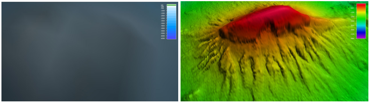
. The right image shows the same feature as mapped with the ship's multibeam sonar – providing a detailed map with 50-meter resolution. This map was used for ROV dive planning.")
Example highlighting the importance of ship-based ocean mapping work. The left image shows Pao Pao Seamount as resolved from satellite-derived bathymetry (barely discernible bump). The right image shows the same feature as mapped with the ship's multibeam sonar – providing a detailed map with 50-meter resolution. This map was used for ROV dive planning.