
Deep Discoverer collects a geological sample at 4,300 meters east of Necker Island. Image courtesy of the NOAA Office of Ocean Exploration and Research, 2016 Hohonu Moana. Download larger version (jpg, 466 KB).
Deep Discoverer collects a geological sample at 4,300 meters east of Necker Island. Image courtesy of the NOAA Office of Ocean Exploration and Research, 2016 Hohonu Moana. Download larger version (jpg, 466 KB).
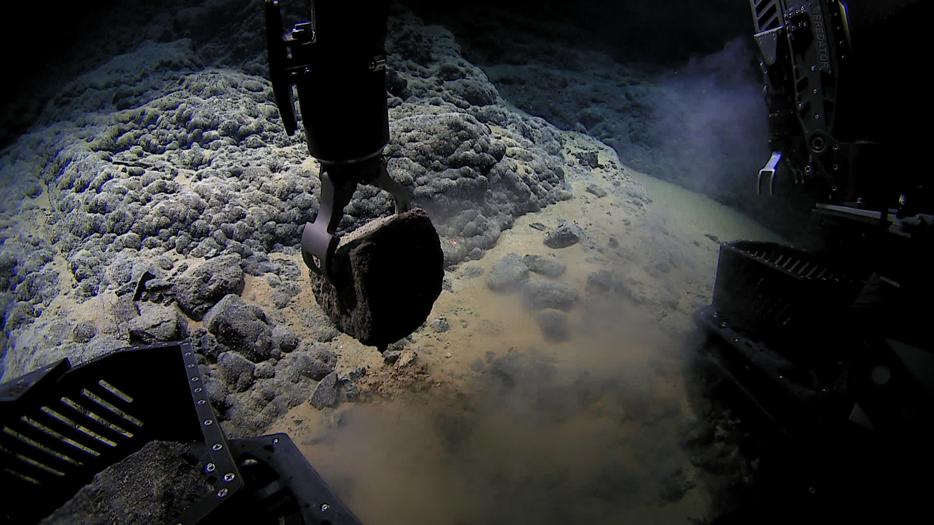
Dive 1: February 27, 2016
During the first dive of the expedition to explore on the northeast side of Necker Island, the Deep Discoverer remotely operated vehicle encountered this octopus, which confused several of our shore-based scientists who have never seen anything like it. Upon further review, this ghostlike octopod is almost certainly an undescribed species and may not belong to any yet-described genus. Video courtesy of the NOAA Office of Ocean Exploration and Research, 2016 Hohonu Moana. Download larger version (mp4, 85.4 MB).
We completed our first remotely operated vehicle (ROV) dive of the cruise on the northeast side of Necker Island (Mokumanamana).
The ROV landed on a flat, heavily sedimented surface at 4,291 meters with weak or nor current. As the ROV moved northwestward towards the slope of the ridge, a few animals were observed including shrimps, sponges, sea anemones, sea cucumbers, and two fish. At ~4,280 meters, the heavily sedimented surface gave way to a more sloped surface with hardpan and isolated pillow lavas. Upon traversing up the slope near a depth of 4,250 meters, lobes of intact flows of pillow lavas were observed. A loose manganese-crusted volcanic rock was collected at 4,245 meters near the base of this flow. As the ROV moved up the slope, a couple of bamboo corals and anemones were observed. Sediment cover continued to decrease upslope to a surface composed of more manganese-encrusted pillow lavas with pockets of sediment. The manganese crusts appeared to be thin relative to the thicker crusts present on older (Cretaceous-age) flows. This observation suggests that these flows are younger in age and were emplaced during Hawaiian volcanic growth ~10 million years ago. A second manganese-crusted volcanic rock was collected at the base of another pillow lava flow very close to the end of the dive, at 4,222 meters.
Overnight, the ship commenced mapping operations. In the middle of the night, the ship received a distress call from a vessel and the U.S. Coast Guard requested we change our course to render aid. After about half an hour of heading towards the distressed vessel, the Coast Guard notified us that our assistance was no longer needed and we returned to our mapping plan.