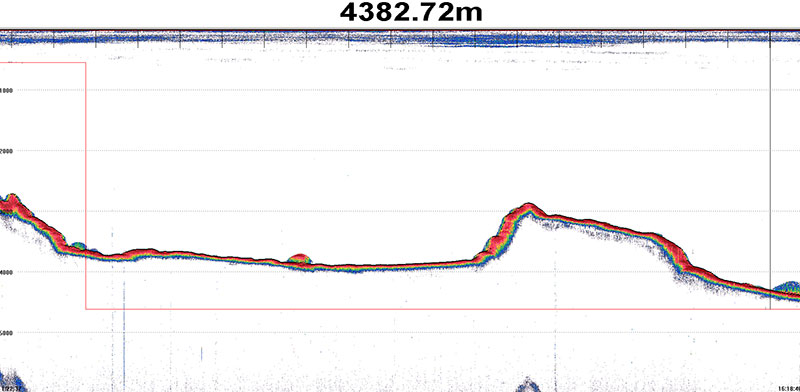
In this screen capture of the EK60 data acquisition screen, you can see the deep scattering layer near the surface. Image courtesy of the NOAA Office of Ocean Exploration and Research, 2016 Hohonu Moana. Download larger version (jpg, 626 KB).

In this screen capture of the EK60 data acquisition screen, you can see the deep scattering layer near the surface. Image courtesy of the NOAA Office of Ocean Exploration and Research, 2016 Hohonu Moana. Download larger version (jpg, 626 KB).
The Okeanos Explorer transited over 350 miles in the last day and a half, on our way to our first dive site near Necker Island. Even though we did not deploy the remotely operated vehicles today, we were still exploring. The Okeanos is equipped with a suite of scientific sonars that not only map the seafloor but also the water column and the geological features just beneath the ocean bottom. As the sun set today, we used one of our water column sonars to watch one of the largest migrations on Earth. Every day, huge numbers of very small organisms come up from the depths at night to feed in shallower waters under the cover of darkness. This layer of organisms is often called the deep scattering layer because of the way it is seen in sonar.