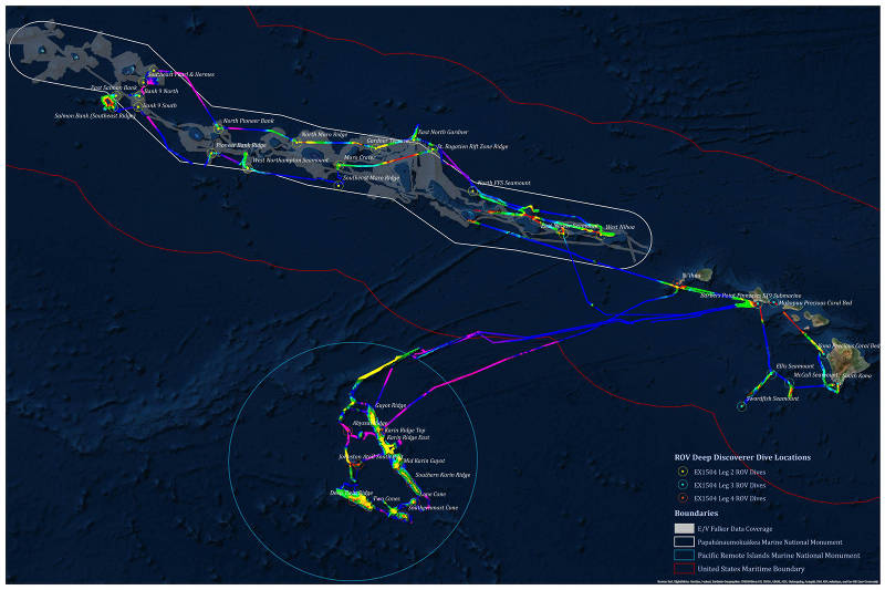
Summary map showing work conducted during four NOAA Ship Okeanos Explorer cruises as part of the EX-15-04 Hohonu Moana Expedition. During the course of three months, 65 days at sea were spent conducting mapping and 37 ROV dives in the Hawaiian Archipelago and offshore of Johnston Atoll. Leg 1 and 4 operations focused on the Johnston Atoll Unit of the Pacific Remote Islands Marine National Monument (blue boundary). Leg 2 operations focused on the Papahānaumokuākea Marine National Monument (white boundary). Leg 3 operations focused on the main Hawaiian Islands and Geologists Seamounts group.
Mission Summary Map
Image courtesy of the NOAA Office of Ocean Exploration and Research, 2015 Hohonu Moana. Download larger version (jpg, 1.5 MB).

Summary map showing work conducted during four NOAA Ship Okeanos Explorer cruises as part of the EX-15-04 Hohonu Moana Expedition. During the course of three months, 65 days at sea were spent conducting mapping and 37 ROV dives in the Hawaiian Archipelago and offshore of Johnston Atoll. Leg 1 and 4 operations focused on the Johnston Atoll Unit of the Pacific Remote Islands Marine National Monument (blue boundary). Leg 2 operations focused on the Papahānaumokuākea Marine National Monument (white boundary). Leg 3 operations focused on the main Hawaiian Islands and Geologists Seamounts group.

Learn more