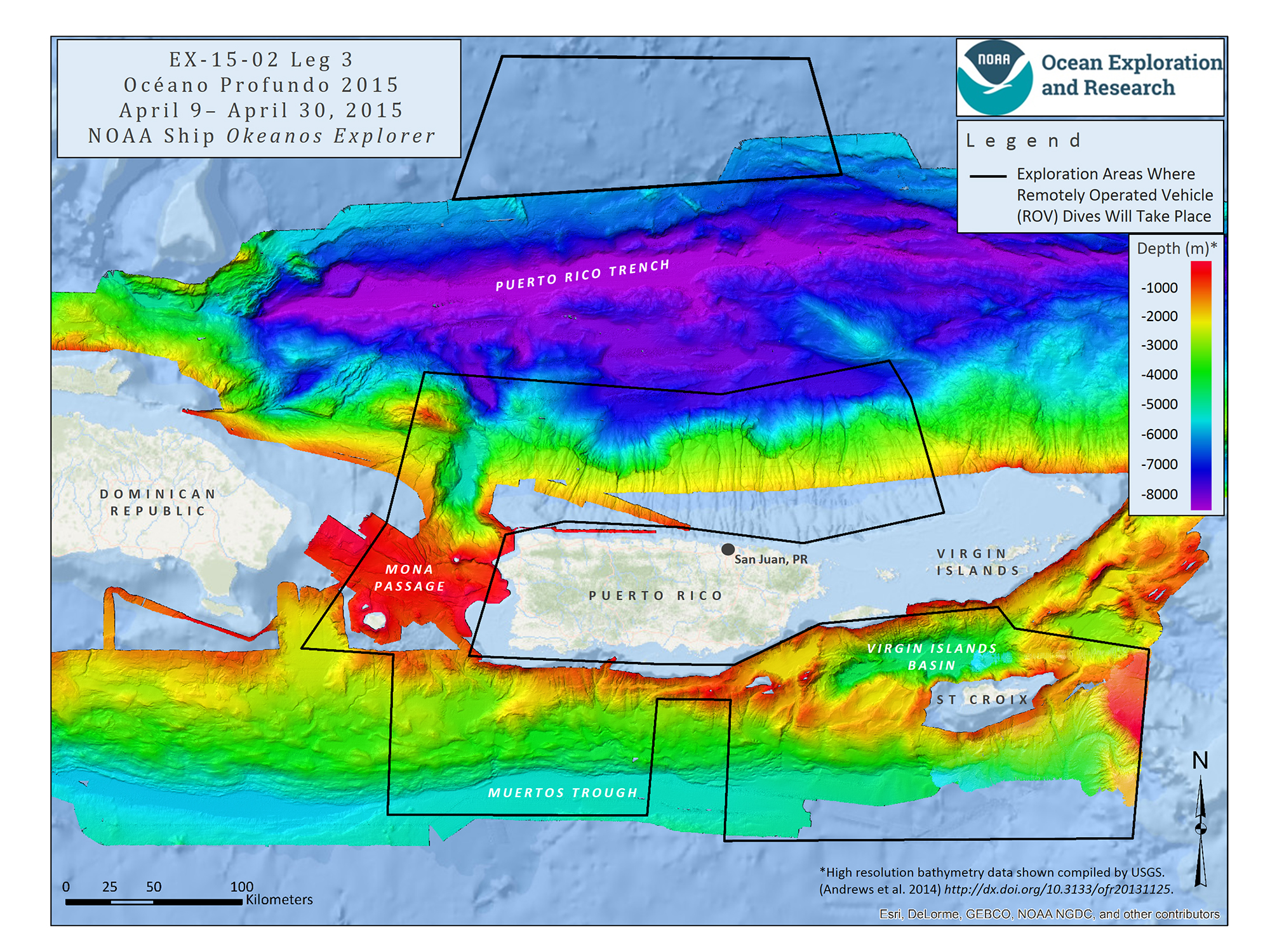
Image courtesy of the NOAA Office of Ocean Exploration and Research, Exploring Puerto Rico’s Seamounts, Trenches, and Troughs.Download larger version (jpg, 2.3 MB).
Mission map showing the operating areas, with priority areas outlined in black, for Leg 3 of the expedition.
