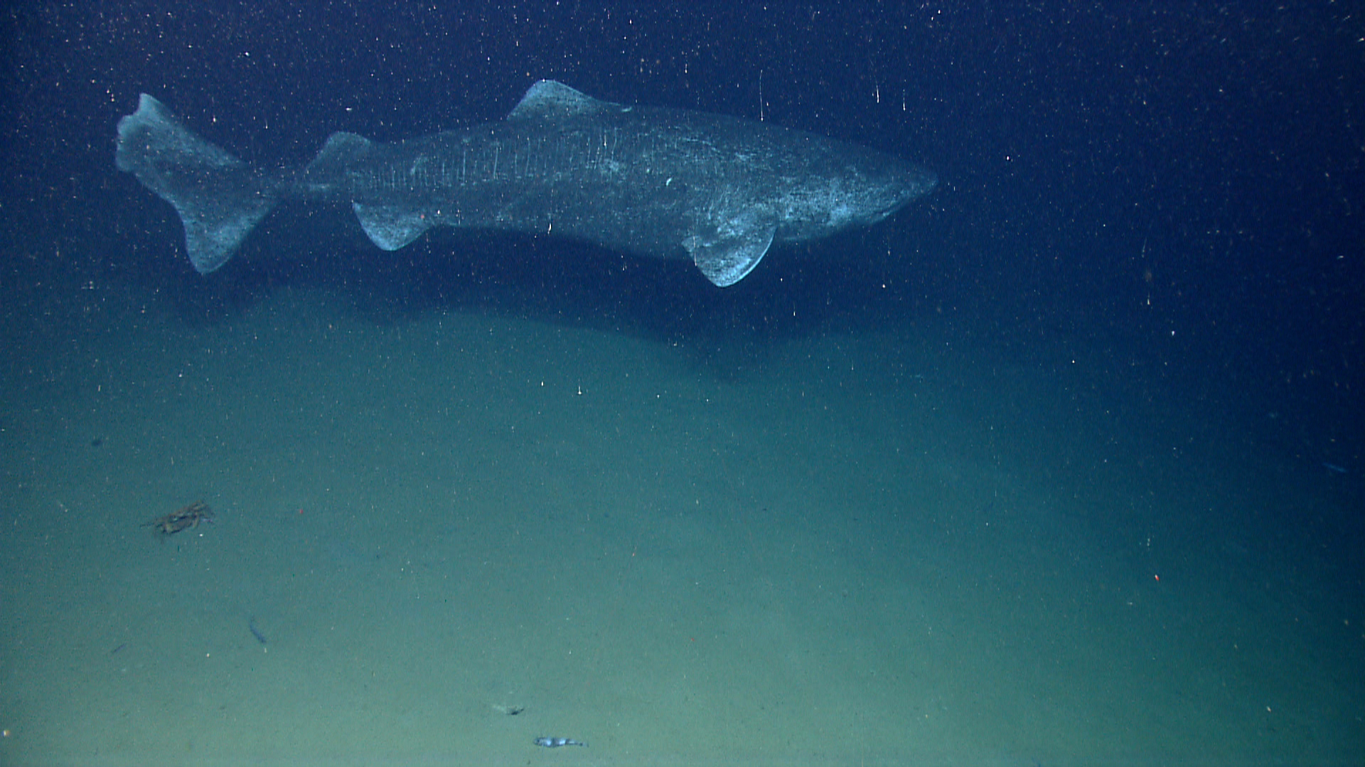
Today we had a relatively shallow dive at a landslide debris field between Alvin and Nantucket Canyons. The remotely operated vehicle (ROV) was on bottom, ready to explore, at 1304 UTC at a depth of 896 meters. The dive started along a smooth, sedimented seafloor that transitioned to hummocky terrain. Several burrows of different sizes were observed throughout the dive, some occupied by red crabs and squat lobsters. The first large rock was observed at 885 meters. The landslide debris area was heavily sedimented, possibly an indication that the landslide had occurred long ago in geological time scales. The ROV transited up a sedimented slope throughout the rest of the dive. Once the ROV reached the top of the ridge at 778 meters, it then moved to the final waypoint target, in search of possible coral habitat. Based on the slope model, this waypoint represented a transitional area between little to no likelihood of coral presence to low to medium likelihood of finding coral. On the soft sediment terrain and in the water column, we observed several fish species, including: Stomias, Cyclothone, possibly two types of eelpouts, witch flounder, black dogfish, catshark (Apristurus), longfin hake, rattails, synaphobranchid eels, duck-bill eels, green eye, gempylids, Antimora, skate, and two other eel types. Several fish parasites were observed, including copepods infesting synaphobranchid eels and an isopod attached to a rattail. At least four different kinds of squid were noted: Chiroteuthis, Illex, Brachioteuthis, and Mastigoteuthis. Several predation events occurred, including a squid eating fish, fish eating something unidentifiable, and crab eating a benthic ctenophore. There were a few items of trash identified, two pieces of monofilament, and an object resembling a five-gallon bucket with a flytrap anemone attached to one side. Very few boulders were noted on the dive; the surfaces were populated by flytrap anemones, serpulid polychaetes, white sponges, and Cottunculus were observed resting at the base of these hard substrates. The boulders appeared rounded, worn, with potentially a manganese iron crust, likely glacial erratics. One of the boulders had a large egg mass on the surface. However, there were some boulders that we were unable to characterize due to limited time. In addition, we saw a large egg case (~10 centimeters across) on the seafloor. Before leaving the bottom, a large shark, identified as a Greenland Shark, was observed in the Seirios camera view, and the Deep Discoverer ROV was able to capture the shark on video. What a way to end a fabulous cruise! The ROV left bottom at 2011 UTC from a depth of 783 meters.
