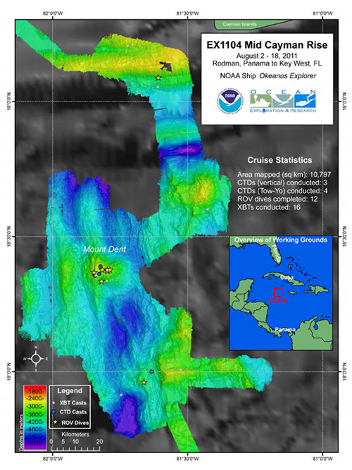
Overview map summarizing the work completed by NOAA Ship Okeanos Explorer and the expedition team during the Mid-Cayman Rise 2011 expedition. Nearly 10,800 square kilometers of the seafloor was mapped during the expedition using the ship’s deep-water multibeam sonar.
Overview Summary Map
Image courtesy of NOAA Okeanos Explorer Program, MCR Expedition 2011. Download larger version (jpg, 2.5 MB).

Overview map summarizing the work completed by NOAA Ship Okeanos Explorer and the expedition team during the Mid-Cayman Rise 2011 expedition. Nearly 10,800 square kilometers of the seafloor was mapped during the expedition using the ship’s deep-water multibeam sonar.

Learn more