
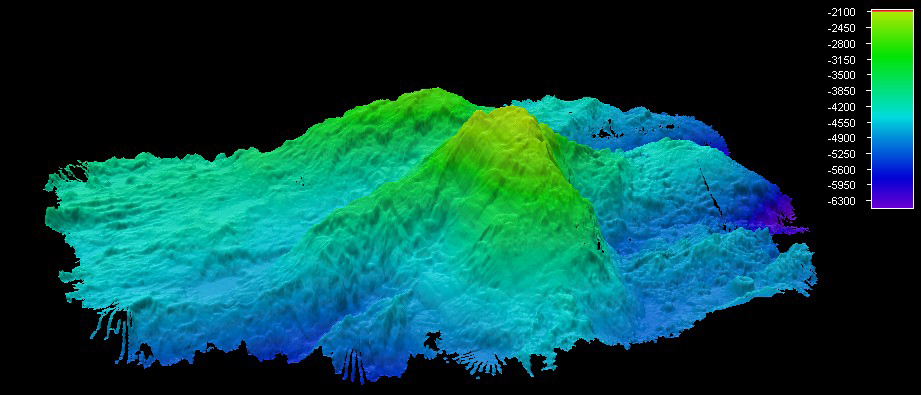
This image shows an overall perspective of the multibeam sonar data collected over the Mid-Cayman Rise so far by the Okeanos Explorer. The perspective is looking west-north-west, and Mount Dent is seen in the foreground. Image courtesy of NOAA Okeanos Explorer Program, MCR Expedition 2011. Download larger version (jpg, 231 KB).