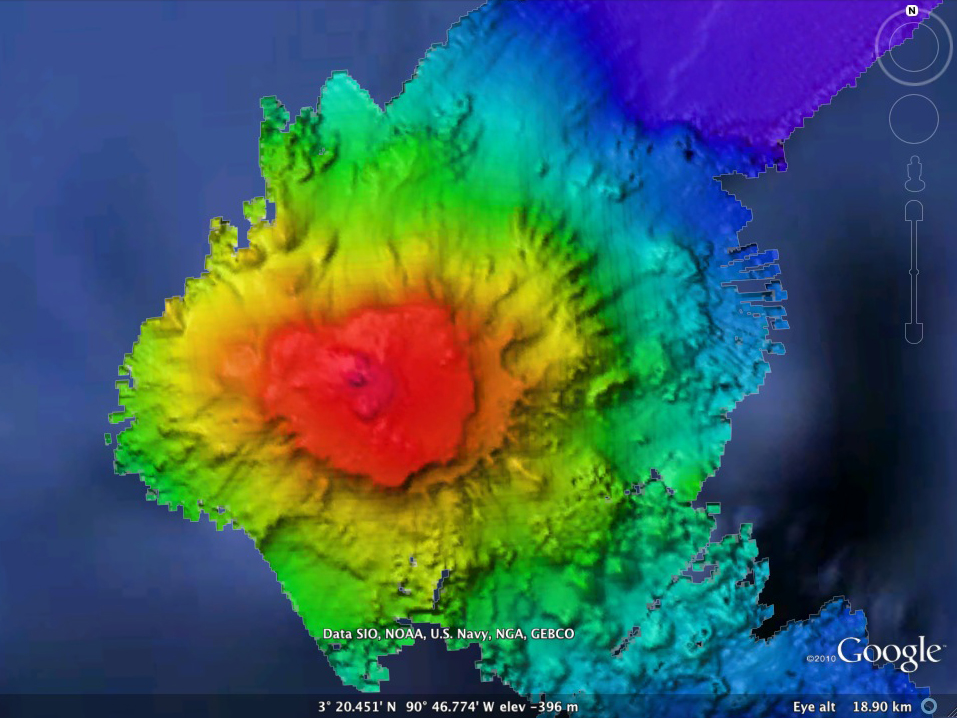
EM302 multibeam sonar data overlaid in Google Earth, showing the seamount in the Paramount chain where the dive was conducted.
