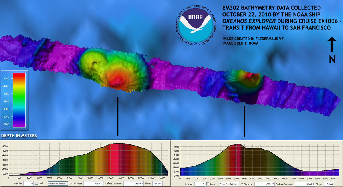
Late last night, the EM302 multibeam sonar on Okeanos Explorer acquired data overtop of two seamounts that previous satellite altimetry data revealed only as relatively small mounds on the seafloor, rising at most a few hundred meters. The ship’s multibeam data, however, revealed these seamounts to be greater than 1000 meters tall. Neither of these features is listed on the available NOAA chart for the area. With the data available onboard the ship, these two seamounts are being marked as two “potential discoveries” and require further detailed research before conclusive statements can be made. This is a common situation aboard Okeanos Explorer – although much data is collected, conclusively determining whether something is “new” or a “discovery” is rarely immediate. Sometimes potential new features such as these seamounts are recognized by scientists or technicians participating in the exploration, whereas other times new or unique findings come later, after the data has been sent to shore and made available for others to comb through to make or catalyze discoveries.
