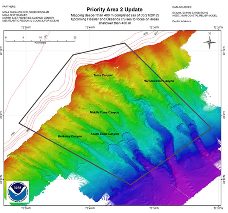
Scientists and managers identified this five-canyon area as the second highest geographic priority. The map displays bathymetry collected during the first ACUMEN cruise. NOAA Ship Hassler will complete mapping of the area in June with high-resolution coverage of the canyon heads.
Collected Bathymetry
Image courtesy of the NOAA Office of Ocean Exploration and Research. Download image (jpg, 117 KB).
Scientists and managers identified this five-canyon area as the second highest geographic priority. The map displays bathymetry collected during the first ACUMEN cruise. NOAA Ship Hassler will complete mapping of the area in June with high-resolution coverage of the canyon heads.
Learn more