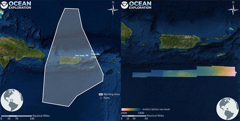
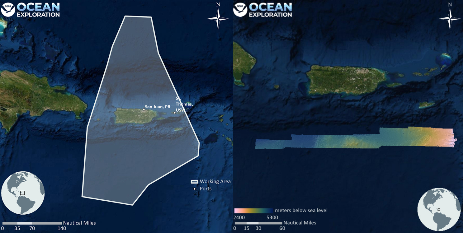
In March 2022, NOAA Ocean Exploration conducted an exploratory ocean mapping expedition focused on U.S. deep waters south of Puerto Rico. The team mapped a total of 8,398 linear kilometers (5,218 miles) and 18,580 square kilometers (7,174 square miles) of seafloor, an area approximately twice the size of Puerto Rico. These mapping efforts resulted in the collection of high-resolution data needed to fill critical mapping gaps in the region and revealed never-before seen morphologic features of the seafloor south of Puerto Rico, including small seamounts.